
Valley of Los Realejos in real time
beautiful views of the sea and the mountains



spectacular sunsets in the valley of Los Realejos
👉 What feeling does it give you right now?
The Pulse reflects how this place is perceived right now.

Perfect day

Strong wind

Rough sea

Very quiet

Ideal Promenade

Variable day
Valley of Los Realejos: nature and culture in the north of Tenerife
The Valley of Los Realejos is one of those corners of northern Tenerife where the landscape encompasses everything: volcanic cliffs, lush forests, plantations of banana trees, and centuries-old estates coexist in just 57 km². Thanks to the live webcam available on this page, you can see in real time the state of the sky, the coast, and the valley before planning your visit. The verticality of the municipality is astonishing: from sea level to the foothills of the summit, with views that reach Teide on the clearest days.
The Atlantic and the mountain face each other in the Valley of Los Realejos, and every turn of the road opens a new horizon. The municipality is historically divided between Realejo Alto and Realejo Bajo, two hubs that preserve parishes with wooden coffered ceilings and a festive life that never rests. Here there is no rush: the landscape sets the pace.
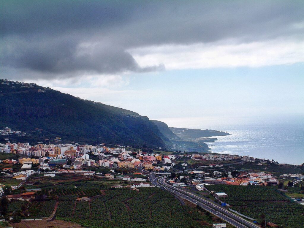
The landscape of the Valley of Los Realejos: coast, midlands, and summit
The valley unfolds on the northern slope of the island, receiving moisture and low clouds from the trade winds in the midlands, which nourishes expansive cloud forests. On the coast, however, the sun warms black sand beaches and rocky inlets nestled among lava flows and cliffs. Names like El Socorro, Castro, Los Roques, La Fajana, or La Grimona come up in conversations among surfers, photographers, and hikers who know this coastline well. Between the ravines of Ruiz and Castro, the intense green contrasts with the blue of the ocean and the tiled roofs, composing the postcard that many seek when arriving in northern Tenerife.
Temperatures are pleasant year-round, with mild winters between 13 and 19 degrees and summers that rarely exceed 26 on the coast. In just a few kilometers, one moves from the temperate coast to the humid midlands and then to the clear summits where Teide dominates the horizon.
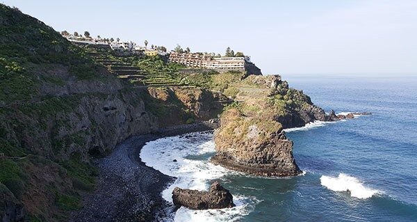
Flora and fauna of the Valley of Los Realejos
The botanical richness of the Valley of Los Realejos varies visibly with altitude. In the high areas, the Canary pine thrives, and in shaded areas and ravines, the cloud forest with fayas and heaths flourishes. Higher up, mountain shrubs and endemics like the red tajinaste appear. In the watercourses, strawberry trees and willows provide shade and freshness. Along the coast, halophilic communities, prickly pears, and tabaibas burst forth, while the natural palm groves of the Rambla de Castro, one of the most beautiful protected landscapes in Tenerife, complete an exceptional mosaic.
The fauna matches the landscape. Seabirds like the Cory's shearwater seek the coast to nest, and raptors like the Berber falcon take advantage of the currents in the Tigaiga massif. In the forests, the song of the blue chaffinch of Teide serves as a reminder that these slopes host exclusive species. Barranco Ruiz and Rambla de Castro are the best points for spotting endemics, especially in the early morning hours.
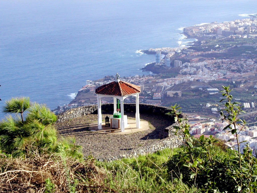
Viewpoints of the Valley of Los Realejos: panoramic views in Los Realejos
The panoramic views in Los Realejos are one of the great attractions of the municipality. The San Pedro Viewpoint offers the best perspective of the palm grove of Rambla de Castro and the historic estates. The Mirador de La Corona, at 750 meters above sea level, is a reference point for paragliding and photography of the entire valley. From the Mirador del Asomadero, at over 1,100 meters, the Teide and the slopes of the Tigaiga massif fill the field of vision. The Mirador de El Lance, at about 600 meters, offers a frontal panorama of the Orotava Valley that stays in memory.
To choose the right moment, it's advisable to check the webcam before heading out: cloud cover changes quickly in the midlands, and a brief wait can make the difference between a covered view and a clear horizon until La Gomera.
Historical heritage and traditions of the Los Realejos Valley
The Los Realejos Valley holds an essential part of the island’s heritage in its three main temples, declared of Cultural Interest. The Church of Santiago Apóstol serves as the mother church of the municipality and is a living manual of Canarian architecture. Our Lady of the Conception preserves Gothic and mannerist stone doorways, restored with respect after the fire of 1978. The Sanctuary of Our Lady of Carmen was built over the old convent of Augustinians, and the Genovese carving of the Virgin of Carmen from 1726 is the heart of a maritime devotion celebrated every July and August with processions and music.
The festive agenda of the Los Realejos Valley is intense throughout the year. The Regional Romería of San Isidro Labrador in May is adorned with costumes, carts, and parrandas along the route. The Crosses and May Fires combine floral art and pyrotechnics with a unique stamp that attracts visitors from all over the island.
Gastronomy and hiking in Los Realejos
The table of the Los Realejos Valley is honest and flavorful. The beautiful potato reigns when it’s time to harvest, and there are plenty of fairs that pay tribute to it. The Canarian black pork, goat cheeses, mojos, and gofio make up an offer that invites you to sit down without a clock. The wines from the DO Valle de La Orotava, with medium-bodied Atlantic reds, perfectly accompany the fresh fish from the coast.
For those who prefer to move, the trail network of the Los Realejos Valley connects sea and mountain through paths that cover coast, midlands, and summit. The Rambla de Castro is the most appreciated route, with palm groves and historic estates along the way. Playa del Socorro is a landmark for surfing and bodyboarding, and Barranco Ruiz offers one of the best ornithological itineraries in northern Tenerife. Those looking for something more intense can try Route -4-, which climbs from the sands of Socorro to the Teide crater.
Frequently asked questions about the Los Realejos Valley
What is visible on the webcam of the Valle de Los Realejos?
The camera shows the northern coast, the valley, and, on clear days, Mount Teide in the background in real time. It is useful for checking visibility and weather conditions before heading out to viewpoints or trails.
How to get to the Valley of Los Realejos?
Via the TF-5 highway, with well-signposted exits towards Los Realejos. Having a car makes it easier to access the viewpoints and the more remote coastal sections. The island buses connect the main hubs with Puerto de la Cruz and La Orotava.
What is the best time to visit the Valle de Los Realejos?
Every season has its charm. Spring and autumn are especially pleasant for hiking. In summer, the trade winds refresh the coast, and in winter, Teide can appear snow-capped in the background of the valley.
Are there beaches in the Valley of Los Realejos?
Yes. Playa del Socorro is the most well-known, with volcanic black sand and good surfing conditions. Other coves like Castro, Los Roques, and La Fajana are accessible on foot via coastal paths.
What to see near the Valley of Los Realejos?
Puerto de la Cruz and its urban beaches are just a few minutes away. Garachico, with its natural pools carved by lava, is another must-see stop. La Orotava and the Teide National Park complete a day in the north of the island.