
Valle de Aridane: Live Panorama
Canarian tradition live among banana plantations and urban art


Experience the panorama of Los Llanos de Aridane today
👉 What feeling does it give you right now?
The Pulse reflects how this place is perceived right now.

Perfect day

Strong wind

Rough sea

Very quiet

Ideal Promenade

Variable day
Panorama of the Aridane Valley: banana plantations, lava, and life live
The panorama of the Aridane Valley is one of the most unique landscapes in La Palma: a terraced farming area open to the Atlantic where banana plantations, white villages, and recent lava flows coexist in a single frame. From the live webcam, you can see in real time the expanse of the valley, the state of the sky, and the contrast between the green crops and the dark volcanic rock before planning your visit or hiking route.
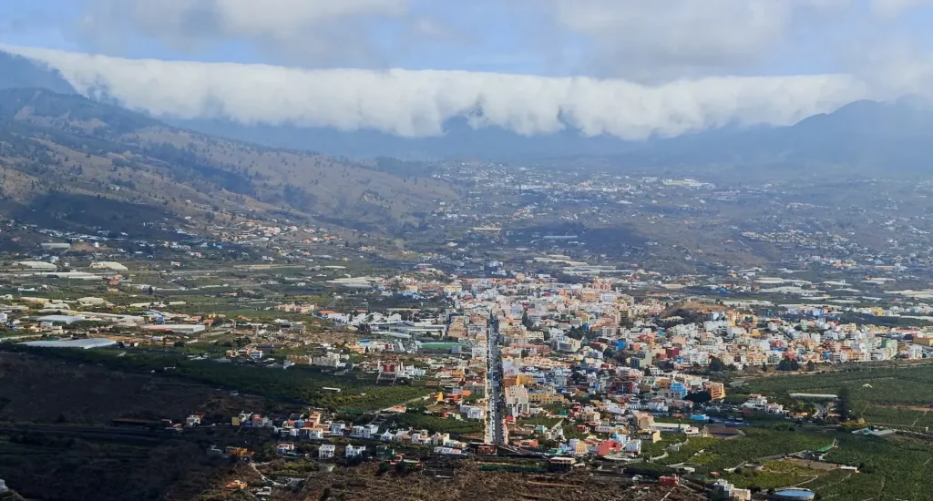
Panorama of the Aridane Valley: volcanic agriculture and evolving landscape
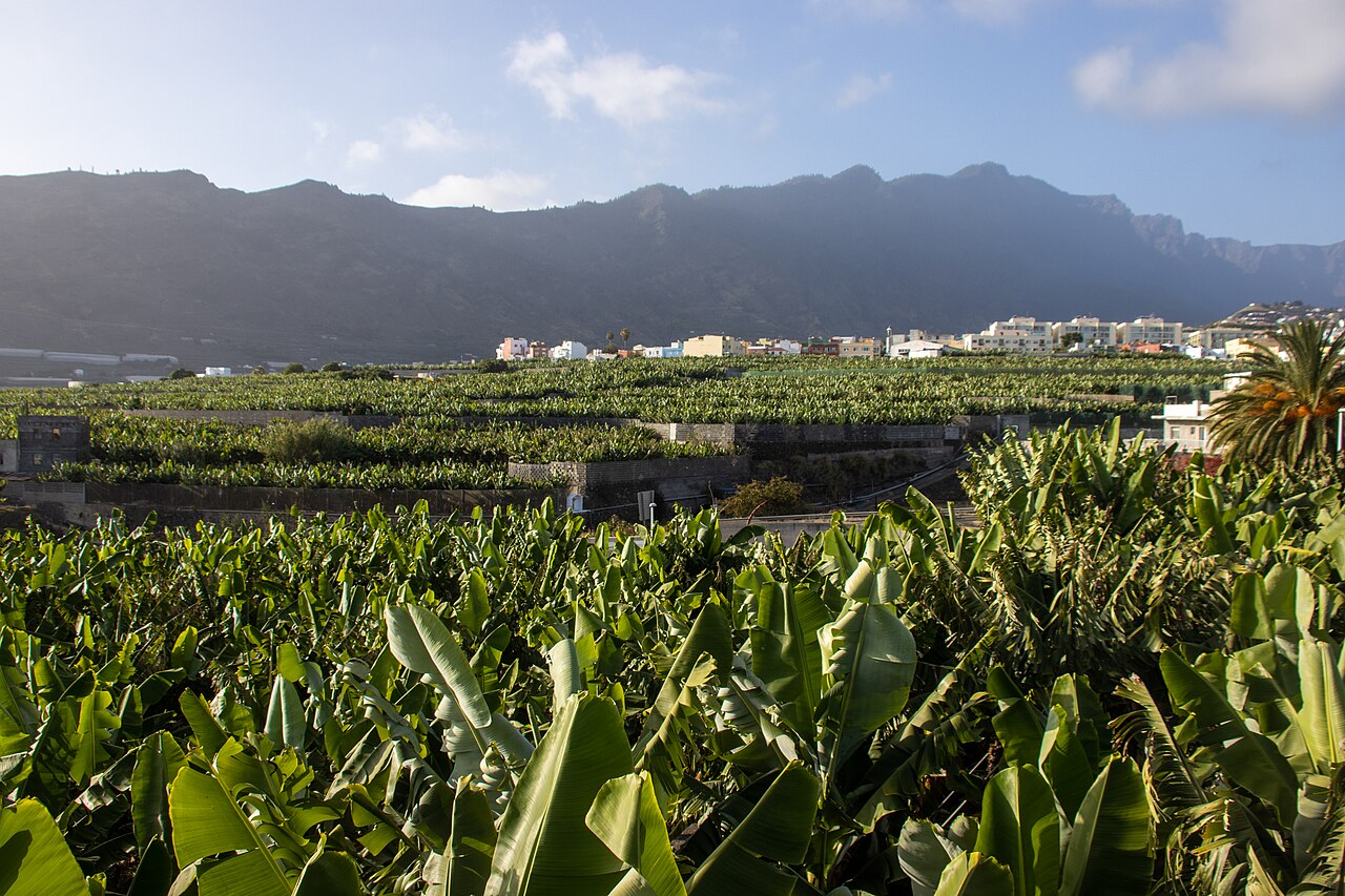
The panorama of the Aridane Valley reveals the agricultural logic of the area with extraordinary clarity. The crops are concentrated below 300 meters in altitude, near the coast, where the sea breeze provides humidity and access to water is easier. The banana plantations, which for decades have sustained the family economy of the west of La Palma, continue to define the aesthetics of the valley alongside avocados, mangoes, and vegetables that diversify production. Moreover, the incorporation of drip irrigation, moisture sensors, and controlled nutrient irrigation techniques has transformed the way of working without altering the visual identity of the landscape.
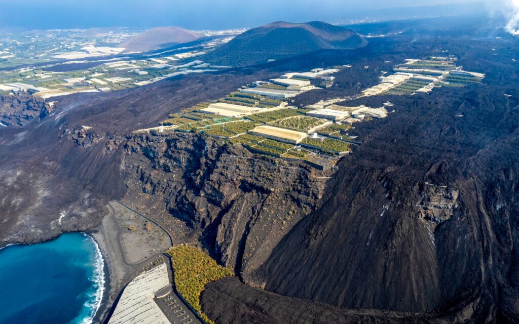
The dark spots visible in the panorama correspond to the lava from the Tajogaite volcano in 2021, which cut roads, flooded farms, and modified the profile of the southern coast of the valley. However, the recovery has been determined: new paths, landscape restoration, and nature tourism projects have turned the affected area into a geologically interesting destination. Therefore, the panorama of the Aridane Valley is not just a static landscape, but a real-time visual document of an area that transforms and adapts.
What to see in the Aridane Valley and how to explore it
The panorama of the Aridane Valley is best appreciated from the viewpoints that line the ridge and edges of the valley. The Mirador del Time offers an aerial view of the entire agricultural terrace and the coast, with the lava delta from Tajogaite visible at the southern end. From the summits of the national park, the contrast between the green of the pine forest and the blue of the Atlantic frames the valley from the opposite side.
At ground level, the urban center of Los Llanos de Aridane is the reference point of the valley, with its Plaza de España, its murals from the CEMFAC program, and its gastronomic offering of local products. Towards the coast, Puerto Naos concentrates the largest black sand beach in the municipality, with calm waters and easy access. Additionally, the neighborhoods of Argual and Las Manchas preserve traditional architecture with lava and lime houses, wooden balconies, and volcanic stone chapels that complete the cultural reading of the landscape.
Everything you need to know about the panorama of the Aridane Valley
What can be seen on the webcam of the Aridane valley panorama?
The camera shows the valley, banana plantations, the outline of the towns, and the state of the sky in real time. It is especially useful for checking if there is fog on the peaks, visibility for photography, or conditions for hiking before heading out.
Where is the best view of the Aridane valley?
The Mirador del Time is the most complete viewpoint, with the entire terraced cultivation area and the ocean in the background. From the Cumbrecita, within the Taburiente Caldera National Park, the perspective is different and allows you to see the valley from the interior of the island.
What crops dominate the landscape of the Aridane valley?
The banana is the main crop and gives visual character to the valley. Alongside it, avocados, mangoes, and vegetables grow in the higher or more difficult irrigation areas. The dark spots in the southern end correspond to the volcanic flow from 2021.
How to get to the Aridane Valley from Santa Cruz de La Palma?
By taking the LP-1 or LP-2 road heading west, it's about a thirty-minute drive. Los Llanos de Aridane is the central hub of the valley and the most convenient starting point for exploring viewpoints, beaches, and hiking routes.
When and how to enjoy the Aridane Valley
When is the best time to visit the panoramic view of the Aridane valley?
The soft light of early morning is the most favorable for photography. Additionally, the last hour of the afternoon offers warm colors over the banana plantations. In winter, on the other hand, the contrast between the green of the crops and the white of the snow-capped peaks adds an extraordinary visual element. In general, spring and autumn are the ideal seasons for hiking.
What relationship does the 2021 eruption have with the valley landscape?
The lava flow from the Tajogaite volcano crossed the southern part of the valley and reached the sea, thus creating a new expanse of lava next to the sea. Today, therefore, this territory is a geologically interesting area that can be visited with a guide. Moreover, it is part of the new nature tourism routes that have been developed after the municipality's recovery.