
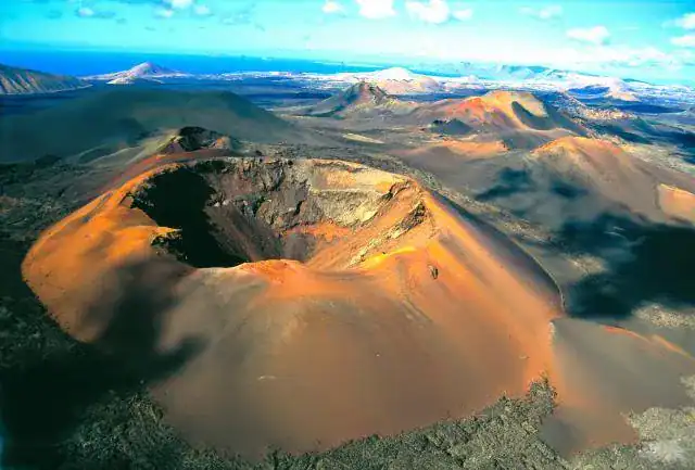
Active volcanoes in the world: about to erupt
There are volcanoes that seem to sleep for centuries and, without apparent warning, remind us that the Earth is alive. Others, on the other hand, maintain an almost constant rhythm, with small eruptions that allow for more refined monitoring. Knowing which might experience volcanic eruptions in the coming years is not divination, but science, data, and prudence.
The good news: today we have sophisticated monitoring networks, models that improve each season, and local communities better prepared. Still, nature retains its capacity for surprise. This balance between knowledge and humility guides these lines.
What does it really mean for a volcano to be 'active'?
The label is not so simple. In geology, a volcano is considered active if it has erupted in the last 10,000 years. Within that category fall everything from systems with daily activity to silent calderas that only stir every few millennia. What concerns civil protection and those living nearby is something else: recent signals of reactivation.
Three key ideas help organize the mental map:
- Active does not imply imminent eruption.
- 'Long rest' does not equate to safety.
- Without continuous monitoring, the margin for maneuver reduces.
Signals that usually precede an eruption
Each volcano has its own personality, although they share patterns. The most observed signals of seismic activity are:
- Seismicity: swarms of small and repeated earthquakes indicating fluid movement or fractures.
- Ground deformation: inflation or deflation measured with GPS, satellite InSAR, and tiltmeters.
- Volcanic gases: changes in CO2, SO2, H2S, or variations in the isotopic ratio suggesting the arrival of new magma.
- Temperature: thermal increases in fumaroles or on the surface detected by cameras and satellites.
- Hydrothermalism: alterations in springs, lakes, and wells, changes in pH, color, or conductivity.
There is no universal recipe. A volcano can show a lot of seismicity and not erupt, while another may go from few warnings to a sudden event with lava flows. That’s why decision matrices, Bayesian models, and probability scenarios are used, with frequent updates.
A look at regions under high surveillance
Pacific Ring
From Alaska to Chile, passing through Kamchatka, Japan, the Philippines, and Indonesia, a large part of global activity is concentrated.
- Kilauea and Mauna Loa (Hawaii): alternate periods of pause with relatively quick resumptions. Kilauea is very reactive to changes in the rift system and in the summit lake. Mauna Loa erupted in 2022 after decades of calm, reminding us that the 'slow giants' also awaken.
- Popocatépetl (Mexico): frequent ash emissions, vulcanian explosions, and ephemeral domes. Intense monitoring and proven protocols.
- Volcán de Fuego (Guatemala): eruptive pulses with pyroclastic flows. High risk for canyons and nearby settlements.
- Nevado del Ruiz (Colombia): eruptive history with the tragedy of 1985 as a permanent warning and a rich volcanic history that continues to be studied closely. Changes in seismicity and degassing require constant attention.
- Cotopaxi and Reventador (Ecuador): variable activity, with Cotopaxi alternating between quietness and sustained emissions.
- Merapi and Semeru (Indonesia): construction and collapse of domes, recurrent pyroclastic flows.
Mediterranean and North Atlantic
This includes Italy, Greece, Iceland, and yes, Spain.
- Etna and Stromboli (Italy): Etna combines lava sources and paroxysms; Stromboli maintains an almost permanent 'heartbeat', with more energetic episodes requiring temporary closures.
- Campi Flegrei and Vesuvius (Italy): the caldera of the Phlegraean Fields shows bradyseism, increased seismicity, and emissions, which have raised vigilance levels in recent years. Vesuvius remains calm, but with defined evacuation plans.
- Iceland, Reykjanes Peninsula: after centuries of quiet, the phase that began in 2021 has brought intrusions and repeated fissure eruptions in a corridor where Fagradalsfjall and areas near Svartsengi stand out. The recurrence in a few years indicates that the cycle could continue.
Africa and the Indian Ocean
- Nyiragongo and Nyamuragira (D. R. of Congo): systems with lava lakes and very fast flows in the case of Nyiragongo. Monitoring challenges due to social and logistical context.
- Erta Ale (Ethiopia): fissural volcanism and persistent lava lake.
- Piton de la Fournaise (Réunion): one of the most 'punctual' in the world. Frequent eruptions but generally well contained within the volcanic enclosure.
Northeast Asia and Alaska
- Sakurajima, Aso (Japan): recurrent explosions and rapid changes in air alert levels.
- Shiveluch, Klyuchevskoy, Bezymianny (Kamchatka): high ash columns, intense events affecting air routes.
- Shishaldin and Cleveland (Aleutians): intermittent explosive episodes.
Europe does have active volcanoes: Canary archipelago in sight
The Canary archipelago is a top-level natural laboratory and the area with the most significant active volcanism within Spain, standing as a true testament to the power of a volcano in the region. The eruption of 2021 in La Palma, like the famous eruption of Teneguía in 1971, showed that the island was not asleep, simply waiting for its moment within a context of volcanic formation. It left a new landscape, a reinforced observation network, and a more prepared society.
- Tenerife, Teide Pico Viejo system: last historical eruption in 1909 (Chinyero). There are no imminent signs, but monitoring is dense. The island shows fumarole fields, low seismicity, and a complex history with central and fissural eruptions.
- La Palma, Cumbre Vieja ridge: episode of 2021 with the opening of several eruptive centers and the emission of lava flows that reached the sea. Instrumentation has multiplied since then.
- El Hierro: seismic-volcanic crisis in 2011 and submarine eruption south of the island. It shows that activity can migrate in depth and react in short periods.
- Lanzarote: Timanfaya 1730 to 1736 and eruptions of 1824. A young landscape that continues to dissipate heat in specific areas.
Institutions that monitor:
- IGN and CGEO for seismicity, deformation, and GNSS networks.
- INVOLCAN for gas geochemistry, thermometry, field monitoring, and technical outreach.
- Copernicus satellite programs and commercial missions with InSAR.
Canary Islands face their volcanoes naturally, but with clear plans. Signage, drills, education in schools, and increasingly refined public communication support this coexistence.
Where monitoring teams look today
This is not a closed list. It is a snapshot of systems with close monitoring and recent or known recurrence signals. The alert levels for volcanoes vary by country and are updated rapidly.
| Volcano or system | Country or region | Dominant type | Last known eruption | Recent signals reported | Main risks |
|---|---|---|---|---|---|
| Kilauea | Hawaii, USA | Basaltic, shield | 2023 | Episodic deformation, SO2 variations | Lava flows, gases |
| Mauna Loa | Hawaii, USA | Shield | 2022 | Slow system rebalancing | Extensive flows, gases |
| Popocatépetl | Mexico | Stratovolcano | Persistent activity | Frequent emissions and explosions | Ash, pyroclastic falls |
| Fire | Guatemala | Stratovolcano | Recurrent activity | Intermittent pyroclastic flows | Pyroclasts, lahars |
| Nevado del Ruiz | Colombia | Stratovolcano | 2016 | Changes in degassing and seismicity | Lahars, ash |
| Cotopaxi | Ecuador | Stratovolcano | 2015 2016 | Sporadic gas and ash emissions | Ash fall, lahars |
| Merapi | Indonesia | Stratovolcano | Continuous activity | Dome growth | Pyroclastic flows, avalanches |
| Semeru | Indonesia | Stratovolcano | Continuous activity | Explosions and pyroclastic flows | Pyroclasts, lahars |
| Etna | Italy | Stratovolcano | Frequent activity | Strombolian paroxysms | Ash, lava |
| Stromboli | Italy | Stratovolcano | Persistent activity | Strombolian explosions | Ballistic projections |
| Campi Flegrei | Italy | Caldera | Holocene, volcanic and hydrothermal activity | Bradyseism, low to moderate seismicity | Emissions, possible phreatomagmatic eruptions |
| Reykjanes (corridor) | Iceland | Basaltic fissure | 2021 2024 | Repeated intrusions, deformation | Flows, gases, impact on infrastructure |
| Sakurajima | Japan | Stratovolcano | Frequent activity | Volcanic explosions | Ash, ballistic |
| Shiveluch | Russia | Stratovolcano | 2023 | High ash dispersion | Ash in flight paths |
| Nyiragongo | Democratic Republic of Congo | Stratovolcano | 2021 | Regional seismicity | Very rapid lava flows |
| Piton de la Fournaise | Réunion | Shield | Regular eruptions | Low magnitude deformation and seismicity | Flows within the enclosure |
| Teide Pico Viejo | Spain, Tenerife | Central complex | 1909 (Chinyero on the ridge) | Diffuse degassing, low seismicity | Emissions, future fissure eruptions |
| La Palma (Cumbre Vieja) | Spain, La Palma | Basaltic fissure | 2021 | Heat dissipation, enhanced monitoring | Flows, gases, ash |
Note: aggregated data from public observatory reports until 2024. Exact alert levels change rapidly and should be confirmed in official sources.
How scenarios are predicted
Predicting does not mean setting a date for an eruption. It estimates conditional probability over a given period, with scales ranging from days to months. Common tools:
- Seismic networks and automatic signal extraction. Models that distinguish between tectonic and volcanotectonic seismicity.
- Continuous GNSS and InSAR to see inflation or deflation in millimeters per month.
- Gas chemistry in the field and by remote sensing. SO2 is a sensitive indicator for basaltic magmas; CO2 is earlier but difficult to interpret due to diffuse emitters.
- High-resolution terrestrial and satellite thermography.
- Numerical models of magma ascent and pressure in reservoirs, updated with Bayesian methods as new data arrives.
- Ash fall and flow simulators with real-time meteorological inputs.
With this arsenal, observatories issue bulletins and, when necessary, change the color of the volcanic traffic light. These changes are not intended to cause alarm but to open avenues for civil protection and citizen action.
Interpret traffic lights and alerts
There is variation between countries, although the general scheme goes from green to red. Some practical ideas:
- Green: no anomalous signals. Routine monitoring.
- Yellow: noticeable changes in one or several parameters. Enhanced preparedness.
- Orange: consistent signs of possible eruption or limited eruptive activity that could intensify.
- Red: ongoing or very likely eruption, with air restrictions and protective measures in place.
It's advisable to subscribe to alerts from the local observatory and not to spread audios or maps of dubious origin. Misinformation complicates the response.
Travel to volcanic areas without losing calm
Scientific and nature tourism coexists with geological activity. There are responsible ways to enjoy it.
- Consult the local observatory before traveling.
- Respect perimeters and closed trails, even if everything seems calm.
- FFP2 mask in environments with gas or ash, protective glasses, and extra water. Ash irritates eyes and airways.
- If driving, avoid traveling with thick ash in the air or on the asphalt. Visibility drops in seconds and traction worsens.
- Have a simple communication plan with your group and a meeting point.
In the Canary Islands, the visitor centers of Teide, Timanfaya or La Palma provide updated information. A local guide with geological training makes a difference.
Living near a volcano: risk culture
Communities that coexist with volcanoes develop a practical relationship of respect and keep their volcanic assets under constant surveillance. Some useful guidelines:
- Know the evacuation routes and meeting points in your municipality.
- Always have a basic backpack ready:
- Documents and digital copy.
- Flashlight, batteries, portable radio.
- Water, energy bars, medication.
- Masks and glasses.
- Charger and external battery.
- Check filters and seals of your house. Ash easily infiltrates.
- Practice family drills. The day you need to leave, the mental time will already be gained.
Specific dangers to remember
Not all eruptions are the same. The composition of the magma, the available water, and the topography determine the type of dangers.
- Lava flows: predictable in direction and speed, very destructive to infrastructure.
- Pyroclasts and ballistics: hot projectiles, especially near the craters.
- Pyroclastic flows: mixtures of gas and particles at high temperature and speed. They are lethal. They can only be avoided by distance.
- Lahars: volcanic mudflows that descend through ravines after rains or snowmelt. They can appear hours or days later.
- Ash: affects health, crops, water, and airports. Its management requires sustained logistics.
- Gases: CO2 can accumulate in low areas and enclosed spaces; SO2 irritates and damages crops.
Open science and citizen participation
The quality of monitoring improves when researchers, administrations, and citizens collaborate. Valuable examples:
- Low-cost sensor networks integrated with official stations.
- Citizen science programs to sample ash and document changes in springs.
- Publication of nearly real-time data that allows independent analysis and social auditing.
The Canary Islands and several observatories in Latin America have made significant progress in this direction. Transparency strengthens trust and dispels rumors.
Tools and reliable sources to track activity
- Smithsonian Global Volcanism Program: historical sheets and weekly bulletins.
- VAACs (Volcanic Ash Advisory Centers): alerts for aviation.
- USGS HVO and AVO: bulletins from Hawaii and Alaska.
- INGV Italy: Etna, Stromboli, and Campi Flegrei.
- IMO Iceland: deformation, seismicity, and intrusion maps.
- IGN and INVOLCAN in Spain: seismicity, geogas, outreach reports.
- Copernicus EMS and Sentinel Hub: satellite images for the public.
Subscribe to bulletins, not just to social networks. Technical details are usually in the PDFs.
Which are most likely to activate soon?
The responsible response talks about ranges of probability and time windows. With the public information available until 2024, candidates under close monitoring for recurrence or persistent signals include:
- Popocatépetl, Merapi, Semeru, Sakurajima, and Piton de la Fournaise due to their pattern of activity close to continuous.
- The Reykjanes ridge, near places like Eyjafjallajökull, has experienced intrusions within a few years and could maintain the cycle.
- Etna and Stromboli, alternating between quiet phases and paroxysms.
- Nevado del Ruiz and Cotopaxi when gas and seismicity increase.
- Kilauea, with reactivations responding to changes in pressure at the summit and rift zones.
In Western Europe, the Canary Islands maintain high-resolution monitoring. There are no immediate eruption warnings, but the geological history and instrumentation suggest keeping technical vigilance always high.
Eruption and after: the long path to recovery
Management does not end when tremors cease. A phase equally demanding begins:
- Cleaning and managing ash, which can be reused as aggregate if properly classified.
- Rehabilitation of agricultural soils. In basaltic environments, young ash can improve in the medium term, but in the short term, it requires careful handling.
- Reconstruction of services and new urban planning with updated hazard maps.
- Attention to the mental health of the population. Prolonged stress and grief over losses are real and require support.
The eruption in La Palma left examples of public-private cooperation, innovation in civil works regarding hot flows, seismic activity, and institutional learning that is now shared with other regions.
A future with better eyes and ears
Next-generation satellites, machine learning applied to seismology, and low latency in sensor networks promise finer alerts. They do not eliminate uncertainty, but they do narrow it down. This technical progress buys time, and time saves lives.