
Stream live the 6 webcams of Santa Cruz de Tenerife


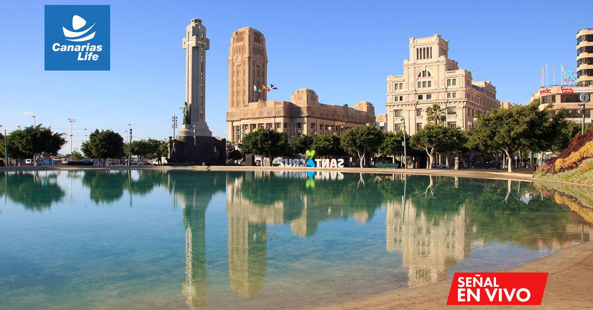


A full day in Santa Cruz de Tenerife, from Cabo Llanos to Benijo beach, with six stops and a live webcam at each one. In the morning, the city on foot: the Auditorium, the Maritime Park, and the center up to Plaza de España. In the afternoon, the coast: Las Teresitas and finally, Anaga. Before heading out, stream the route live: click a stop on the map or activate the automatic route to see the current state of the sky, sea, and streets.
The route at a glance
Six stops from south to north, about 32 km in total. The first four are in the center and are done on foot, in about 3 km. Then, car or bus to Las Teresitas and mountain road to Benijo. The times are indicative: if a stop is crowded or windy, check the webcam and adjust the plan.
| # | Stop | Moment | Ideal for |
|---|---|---|---|
| 1 | Auditorium and Maritime Park | 9:30 | Architecture and sea water pools |
| 2 | Avenida Tres de Mayo | 11:30 | Shopping and coffee |
| 3 | Plaza de la Candelaria | 12:30 | Walk along Castillo Street |
| 4 | Plaza de España | 13:00 | Photo by the lake and food in the center |
| 5 | Las Teresitas Beach | 15:00 | Swim in calm waters |
| 6 | Benijo Beach | 18:00 | Sunset in front of the rocks |
Morning: Cabo Llanos, the Auditorium, and the Maritime Park
The route starts in the south of the city, at Cabo Llanos, the modern area by the sea. This is the time with the best light for photos of the Auditorium and with fewer people on the promenade.
1. Auditorium and Maritime Park
Start by the sea, at the Tenerife Auditorium Adán Martín, the large white sail by Santiago Calatrava, inaugurated in 2003. Right next to it is the César Manrique Maritime Park, opened in 1995: three seawater pools among palm trees and lava, with views of the ocean. If you fancy a swim before entering the city, this is the place. Live webcam of the Auditorium and Maritime Park.
Check before you go: Open the webcam of the Auditorium and Maritime Park at dawn. If the sky is clear over the sea, the day will be good for the whole route, also for Anaga.
Noon: the center, from Tres de Mayo to Plaza de España
From the Maritime Park to the center is about a ten-minute walk. Here the route passes through the liveliest streets of the capital, with shops, terraces, and historic buildings.
2. Avenida Tres de Mayo
The main artery of Santa Cruz: shops, offices, and a lot of movement. Just a few steps away is the Intercambiador, where the buses and the tram depart, making it a good point to orient yourself or have a coffee before continuing. Live webcam of Avenida Tres de Mayo.
3. Plaza de la Candelaria
The historical heart of the center. In the middle of the square stands the Triunfo de la Candelaria, a marble monument from the 18th century dedicated to the patron saint of the Canary Islands. From here, Castillo Street, the main pedestrian and commercial street of the city, branches off. Live webcam of Plaza de la Candelaria.
4. Plaza de España
Just two minutes, next to the port, is the largest square in the Canary Islands. Its central lake and the Monument to the Fallen are the classic photo of Santa Cruz, and in February it is the main stage for Carnival. It’s a good time to eat in one of the streets in the center before heading to the beach. Live webcam of Plaza de España.
Look before you go: On cruise days, events, or Carnival, the center fills up. Compare the webcams of the two squares and choose the quietest hour.
Afternoon: Las Teresitas
From Plaza de España to Las Teresitas, it's about 9 km along the coast, about 15 minutes by car. The bus line 910 from Titsa leaves from the Intercambiador and goes to the beach.
5. Playa de Las Teresitas
Next to the fishing village of San Andrés, about 1,300 meters of golden sand brought from the Sahara in the 1970s, with palm trees and the Anaga mountain behind. A breakwater of about a kilometer protects it from the waves, so the water is usually calm, ideal for families. If you're hungry, San Andrés is known for its fresh fish. Live webcam of Playa de Las Teresitas.
Look before you go: On summer weekends, parking fills up quickly. The webcam tells you if it's worth going now or waiting until mid-afternoon.
Sunset: Benijo, in Anaga
The last stretch crosses the Anaga massif via mountain roads, with many curves: about 20 km and around half an hour, passing through Taganana. Anaga is a Rural Park and Biosphere Reserve, with laurisilva in the peaks and a wild coast to the north.
6. Playa de Benijo
The route ends at a black sand beach in front of the rocks of Anaga, one of the wildest in Tenerife. Here, the sea is usually rough and there are strong currents, so it’s more for walking and looking than for swimming. Its peak moment is the sunset, with the rocks silhouetted against the sea. The area’s restaurants, with views of the beach, are a good place for dinner. Live webcam of Playa de Benijo.
Look before you go: Open the Benijo webcam in the afternoon. If the clouds cover the rocks or the sea is too rough, stay at Las Teresitas and leave Anaga for another day.
Practical tips
- Getting around: On foot from Cabo Llanos to Plaza de España; then, car or bus to Las Teresitas, and car for Anaga. The bus also goes to Taganana and Almáciga, but there are few services a day: check the Titsa schedules.
- Where to park: In the center, a subterranean parking lot is better, like the one at Plaza de España. In Benijo, spaces are limited: arrive before sunset.
- Two-day version: Day 1, the city and Las Teresitas; Day 2, Anaga at a leisurely pace, with a trail through the laurisilva in the morning and Benijo at sunset.
- What to bring: Comfortable shoes for the city, something warm for the peaks of Anaga, and sun protection for the beach.
- The webcams, your weather companion: save the page of webcams of Santa Cruz de Tenerife on your mobile and check it before each stop.
Common questions
Can the route be done in one day?
Yes. It’s about 32 km and the central part is done on foot. If you want to swim calmly at Las Teresitas and walk in Anaga, it’s better to divide it into two days.
How to get to Benijo without a car?
By bus from the Intercambiador in Santa Cruz, with transfer or direct line depending on the schedule. There are few services a day, so check the Titsa schedules before you leave and don’t miss the last bus back.
Is it safe to swim in Benijo?
Only with calm seas. It’s a beach open to the north, with strong waves and currents. Check the webcam before you go, and if there are waves, enjoy it from the sand.
How do I know if the weather is good before leaving?
Use the live route on this page or open the webcam for each stop. You will see the sky, the state of the sea, and how many people are there at that moment.