
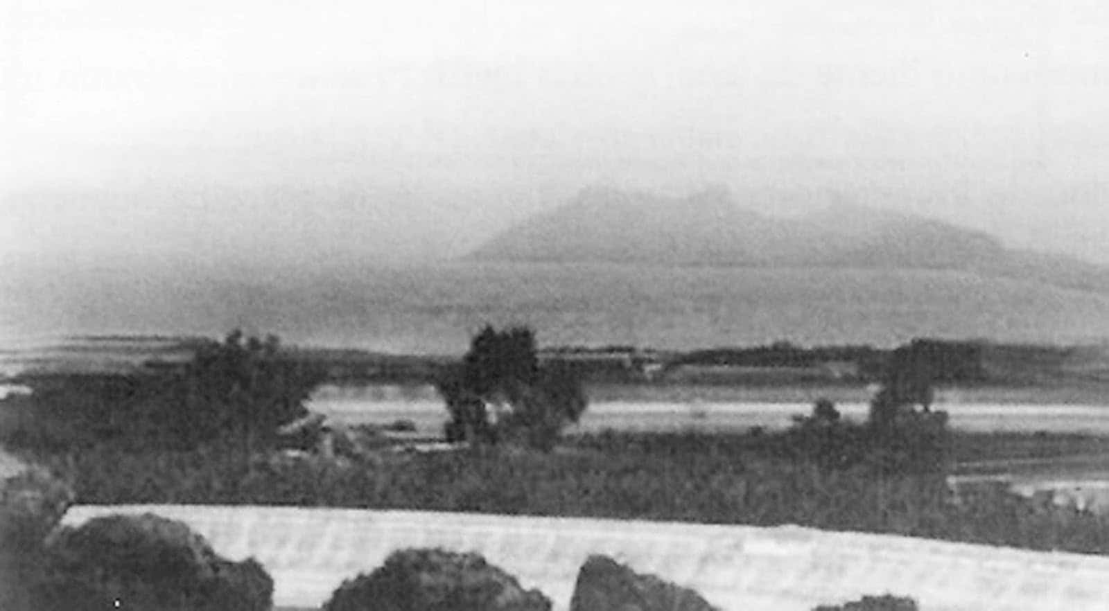
The legend of San Borondón in maritime history
For centuries, fishermen, shepherds, and pilots swore they saw, to the west of La Palma and of El Hierro, a vast land that one day rose with perfect outlines and the next day faded away as if the sea had swallowed it. They called it Non Trubada, Encubierta, Inaccessible. Today we know it as San Borondón, a mysterious island that has ignited the imagination in the Canary Islands archipelago. Few legends have stood the test of time with such strength. Perhaps because, even refuted by science, it still speaks to our habit of looking at the horizon and wondering what lies beyond, and that is what the legend of San Borondón speaks of.
An Irish origin with an Atlantic flavor
The seed of history germinates in the Irish monasteries of the High Middle Ages. Abbot Brandán of Clonfert, a saintly navigator for some and a literary hero for others, features in the Navigatio Sancti Brandani, a hagiographical account that takes him across remote seas, moral trials, and visions of blissful islands. In that journey, a serene, fertile land appears, hiding and reappearing, named by the scribes as the island of San Brandán. The phonetics, already in Hispanic lands, transformed Brandán into Borondón, and that transformation widened the fascination for that mysterious island, merging Celtic traditions and distant echoes from the East.
It is not an isolated tale. It carries ancient mythologies, from the Hesperides and the Insulae Fortunatae of the classics to the Celtic imramas, and even influences from Guanche culture, which complicate the imaginary surrounding the identity of the Canary Islands. The silhouette of the island that flees and returns is an image that fits many traditions of border seas, those spaces where cartography was still a promise.
With the advance of colonization and Atlantic trade, the legend settles in the Canaries. It becomes oral, enters romances, and is discussed in pulpits and gatherings. The local population incorporates it into their family repertoire with proper names: Encubierta, the one that cannot be reached, the one that can be guessed at dusk from the Gulf of El Hierro or from the peaks of Garafía. Prestigious chroniclers, such as Viera and Clavijo, mention it. Clerics and scholars of the 18th century, led by Feijoo, subject it to the critical gaze of the time. And yet it remains, changing accents as the language that tells it changes.
Its Atlantic character deserves mention. From Galicia to Ireland, Celtic resonances are recognized. And the name, with its unmistakable music, jumps to the other side of the ocean, where it appears in American toponyms. The legend left the medieval cloister and became archipelago, and then the whole ocean.
Maps, expeditions, and disappointments
There were maps. Many. For five centuries, medieval and Renaissance portolans depicted phantom lands off the west coast of Africa. In some cases, San Borondón appeared as a well-defined eighth island, with profiles resembling La Palma. In others, it was a broad block west of El Hierro. Engineers and renowned cosmographers drew it, convinced it was there, within reach of the first governor to plant a flag.
There were also coordinates and royal licenses. By the end of the 15th century, while the conquest of the Canaries was being completed, several Portuguese and Castilian pilots searched for that shadow. Reports of sightings multiplied, containing descriptions of ravines, pine forests, and blue mountains. In 157, the Crown authorized an expedition dedicated to confirming its existence. It returned with nothing. In the following centuries, attempts would continue, now with improved cartography, also without result.
A handful of dates and names helps to grasp this longing to find the elusive:
- 1486, Fernão Dulmo organizes an attempt westward, convinced there are lands to gain.
- 159, Leonardo Torriani notes in his letter about the Canaries the island of San Borondón, well-located regarding the Fortunate Islands.
- 157, an expedition under the command of Philip II departs with explicit orders to verify the eighth island. It returns with doubts and conflicting reports.
- 1721 and 1732, Governor Juan de Mur y Aguirre promotes new searches. Again, sea and silence.
- 173, Benito Jerónimo Feijoo, in the midst of the Enlightenment critique, gathers arguments against the authenticity of the island.
- 1865, the Briton Edward Harvey claims to have landed, even providing drawings and photographs. Upon scrutinizing his evidence, his reputation falls apart.
What was the reason for this persistence? A mix of desire and technical uncertainty. Because there were also mistakes. Before the marine chronometer, it was very difficult to establish longitude accurately. Expert sailors could misplace a known coast and swear they had touched new land. If, in addition, the atmosphere played tricks with the light, the deception was convincing.
What did they really see? Mirages, navigation, and geology.
The response offered by current science is clear: in the coordinates attributed to San Borondón, there is no emerged island or remnants of a volcano that could have surfaced historically. Bathymetric campaigns and geological studies have detailed the seabed of the Canary surroundings. Submarine mountains, fossil ridges, and dormant volcanic cones thousands of meters below the surface are known. None meet the conditions to have been, in human times, an island that appears and disappears.
So, why did so many eyes see her? Because of the light. In the Canary Atlantic, thermal inversions and certain configurations of the air mass that generate complex mirages, collectively known as fata morgana, are relatively frequent. These phenomena project, invert, and stretch the image of the real coast. The same relief can multiply in layers over the horizon. An already existing island can appear as another, floating and distant. On days of extraordinary calm, the silhouette of La Palma or El Hierro can become distorted until it is unrecognizable to someone observing from an unusual angle. And as the weather conditions change, the scene fades away.
The nautical factor enhances the illusion. Without a reliable method to measure longitude, the calculation of position depended on estimation, currents, and visual references. If a mass of land was seen where the map did not expect it, it was assumed to be new. If the pilot also did not find it again, their account naturally adjusted to the idea of an elusive island that could only be seen from time to time.
There were critical voices even in times of credulity. Feijoo gathered testimonies and compared them. Where one captain spoke of forests, another spoke of a plain; where one gave a northwest heading, another swore to the west. The sum seemed to him a collection of chimeras, and he said so plainly. His influence opened a skeptical path that, with modern oceanography, has ultimately prevailed.
Despite this, the legend remained alive. Because people love riddles. And because nothing prevents someone, on a clean calima Sunday, from seeing a shadow over the sea line that they did not expect.
Minimal chronology of a tenacious myth
A summary helps to identify the main documentary and cultural milestones. The history is not linear, but recognizable in these stops:
| Era or year | Reference or fact | Why it matters |
|---|---|---|
| IX to XII centuries | Circulation and copy of the Navigatio Sancti Brandani | Consolidates the archetype of the blessed island that appears and disappears, associated with a sailing saint. |
| XIII to XV centuries | Mediterranean and Atlantic portolanos include western islands | Cartography mixes geography and tradition, and establishes the expectation of lands to be located. |
| 1479 to 148 | Treaty of Alcáçovas and Atlantic partition | Talk of 'islands to be gained,' a formula that legitimizes searches and fuels imagination. |
| 157 | Expedition approved by Philip II | High point of the ambition to officially find it, without confirmation. |
| 159 | Torriani draws San Borondón on his map of the Canaries | Technical representation of a geography already very observed, but still permeable to myth. |
| 173 | Feijoo dismantles the illusion with rational arguments | Beginning of the illustrated rejection of the wandering island in cultured environments. |
| Late XVIII century | The myth is ridiculed in travel chronicles | The literate culture turns toward skepticism, while popular tradition upholds it. |
| 1979 to today | Songs, works, festivals, and exhibitions revive the legend | The phantom island becomes a cultural symbol and adapts to contemporary formats. |
The chronology shows a double inertia: when science considers it finished, art rescues and re-signifies it.
An invisible island that does exist in culture, the legend of San Borondón
A myth that isn't sung, a myth that gathers dust. In the Canaries, the opposite has happened. The island that hides has given verses, notes, and stages. Los Sabandeños brought it into the popular songbook with a ballad that many still remember by heart. In La Laguna, a festival transformed it into a unifying motif, connecting the island accent with other Atlantic music from Ireland and Galicia. On stage, San Borondón has served as a dramatic horizon for stories of ambition, conspiracies, and shadows.
This fusion of beliefs is also intertwined with Guanche culture, where tradition and mythological narrative are part of the storytelling that explains the mystery of hidden lands. Photography was tempted by the metaphor: exhibition series play with mists, backlighting, and indistinct outlines, as if each image tried to capture what, by definition, escapes. There are also references in narrative and poetry, where the island functions as a synonym for yearning, refuge, or a challenge to reason.
In daily life, the name has made its home. For those who choose to live in the Canaries, the legend of San Borondón represents a connection with the Canary essence, a reminder of Canary identity, and a fundamental part of the Canary lifestyle. There are recreational maritime routes that utilize it, school workshops that use it as an entry point to the history of navigation, cultural brochures that invite you to look from specific points for possible 'appearances' when the atmosphere gifts a mirage. Even outside the archipelago, the echo of the toponym traveled with sailors and migrants and left traces in America.
Useful readings for today
A myth with so many lives allows for various keys of reading. These four help to situate it profitably in the present:
- Historical reading. San Borondón summarizes the medieval tension between sacred text, oral tradition, and emerging cartography. Putting in dialogue the Navigatio, portolans, and Canary chronicles explains how beliefs travel, adapt, and resonate with new territories.
- Scientific reading. The story is a classic case of how naked-eye observation leads to erroneous conclusions if method is lacking. Mirages, estimation errors, absence of instruments to measure length and weight of expectation explain a good part of the sightings.
- Cultural reading. The island is a figure that inspires creation. From music building Atlantic bridges to visual arts that play with the visible and the invisible, San Borondón serves as an aesthetic and affective engine.
- Educational reading. It is a perfect tool to work on critical thinking in classrooms and museums: evaluating sources, separating testimony from evidence, understanding how science corrects intuition without nullifying fascination.
Hypotheses and signals, in the manner of a cabinet of curiosities
When reviewing the explanations proposed throughout the centuries, it is helpful to organize them by simple criteria. Not all are equally valid, nor do they answer identical questions:
- Maritime mirages. Highly plausible. It reproduces the pattern of 'appearing and disappearing,' relying on well-known optical phenomena and coinciding with sightings from high points on very clear days.
- Cartographic confusions. Very likely. The silhouettes of La Palma or El Hierro, distorted by the atmosphere and observed from unconventional directions, could have been mistaken for another land. This is compounded by the imprecision in longitude before the 18th century.
- Ephemeral islands from recent volcanic activity. Very unlikely. There is no geological evidence in the area attributed to San Borondón of eruptions capable of raising or sinking an island in historical times. The cataloged underwater mountains do not match the accounts.
- Interested invention. Present in some cases. The example of Harvey and other impostors shows that the desire for fame or profit can also raise islands. It does not explain the entirety of testimonies, only some specific episodes.
- Mythical heritage without empirical basis. Undoubted as a background thread. The legend draws from archetypes of fabled islands and from previous traditions. It serves to understand the narrative form, not the peaks of sightings.
This sum of factors offers a coherent image without forcing imagination or despising it.
Routes, viewpoints, and recommended readings
Those who visit the Canary Islands with curiosity about the topic can combine landscape, archive, and music:
- Viewpoints where shadows have been 'seen' to the west: La Peña and Jinama in El Hierro, El Time in La Palma, high areas of , between ravines, cliffs, and historical hamlets. There are also routes through the forests of and Fuencaliente on days with clear skies. Some of these viewpoints have webcams that allow observing in real time the effects of atmospheric conditions and sometimes capture the illusion of the eighth island.
- Museums and archives: local collections with historical maps, reproductions of portolan charts, and nautical charts where you can locate the eighth island depicted with conviction.
- Sounds: the romance of San Borondón in versions by Canary Island groups, along with Galician and Irish repertoire that underscores the Atlantic kinship.
- Readings: modern editions of the Navigatio Sancti Brandani, 18th-century Canary records that discuss the myth, and recent essays on atmospheric optics applied to historical navigation.
Small rituals give meaning to the experience. Waking up early to see how the sun outlines the islands, carrying a copy of an old map and comparing it with the real coastline, noting in a notebook what the eye believes it sees before consulting a weather app. It's a serious game that connects the emotional with the verifiable.
Why does it continue to interest us?
Because San Borondón encompasses three human passions. The first, the taste for limits, those places where certainty becomes porous. The second, the attraction to promises, especially when they take the form of fertile land within sight. The third, the need to tell stories that explain what cannot be tamed.
Furthermore, it offers a serene teaching: science does not come to destroy the charm, but to name it. Calling fata morgana the mirage does not erase it; it places it. Similarly, mapping what a 16th-century pilot described in trembling phrases allows us to appreciate his skill and limitations. For those who decide to live in the Canary Islands, this fusion of myth and reality translates into an essential component of the Canarian lifestyle and the consolidation of a Canarian identity that transcends the everyday.
Anyone who has spent an afternoon gazing at the horizon knows the feeling. The sea cuts the air like a sharp blade. In the distance, one line separates from another. A dark triangle seems to rise above the silver of the surface. Reason says it is La Palma projected under rare conditions. Imagination, which perhaps today, today just today, invites you to dream live that San Borondón has reappeared, also invites you to dream live. Both responses fit in the same gaze. And this balance explains that the eighth island, although invisible, remains so present.