
What to see in Santa Úrsula, Tenerife
Mirador de Humboldt and views of the valley
Santa Úrsula Tenerife, viewpoints, guachinches, and La Giganta in the north
Santa Úrsula is one of those northern municipalities of Tenerife that most people know only in passing on the TF-5 without stopping. Those who do stop discover a very different offering from coastal tourism: viewpoints over cliffs, vineyards, and great guachinches, a historic center with chapels and stately homes, and a four-meter monumental sculpture that has become the most photographed icon of the municipality. Additionally, the Costa de Acentejo that borders the municipality is one of the wildest and most spectacular marine fronts in the north of the island. You can check the live cameras in Tenerife weather before visiting.
La Giganta and the La Quinta Social Garden
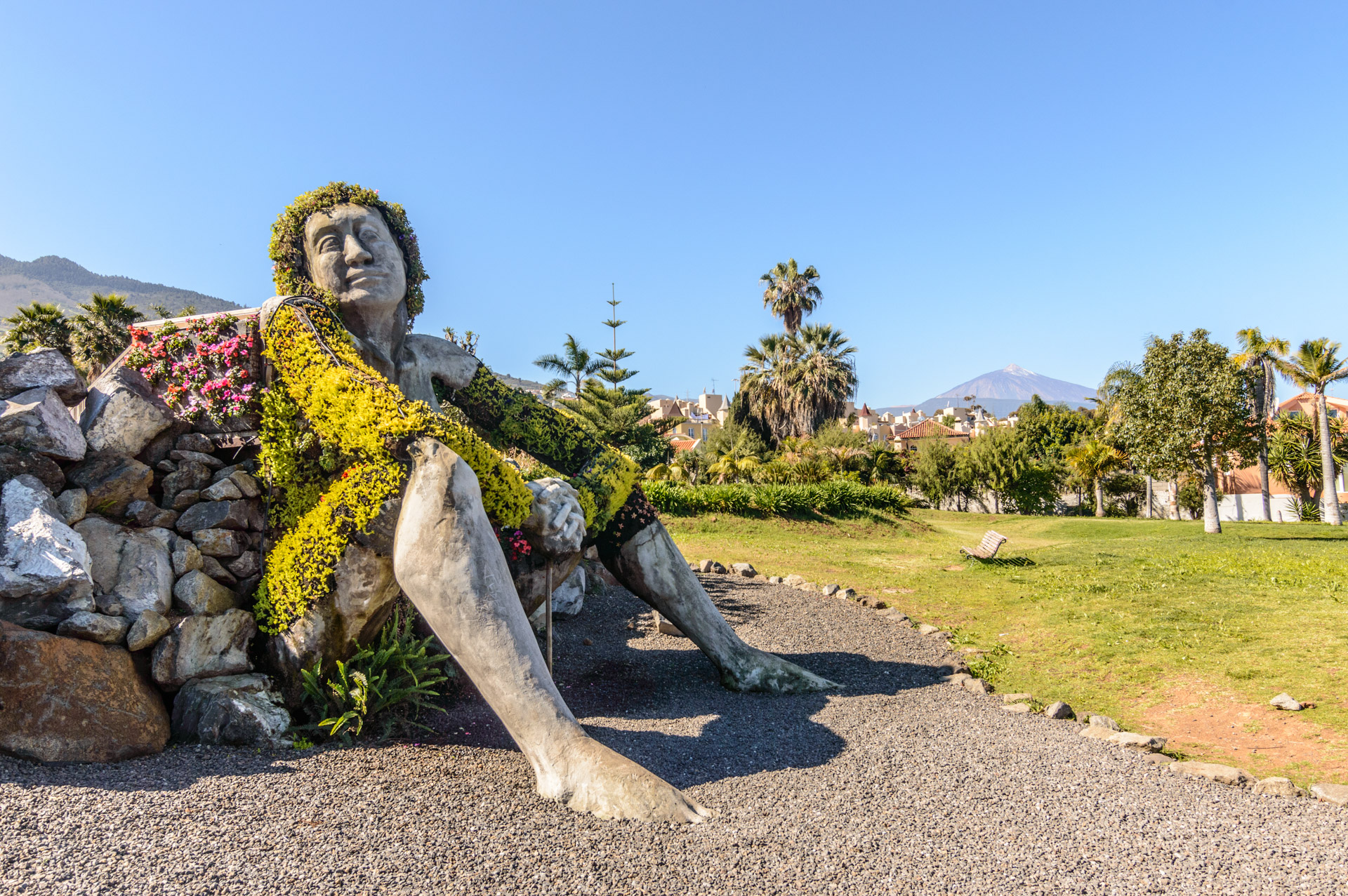
La Giganta is the most recognizable visual symbol of Santa Úrsula. It is a monumental sculpture of a seated female figure, four meters high, with dress and hair made from live plants and flowers. The piece integrates into the La Quinta Social Garden and combines sculpture with landscaping in a way that's hard to find in any other municipality of Canary Islands. Standing next to it to see Mount Teide in the background is one of the most characteristic photos of the north of Tenerife.
The garden itself is a tranquil space with short paths, lots of greenery, and views. It is also the natural starting point to continue towards the La Quinta Viewpoint and the bunker, so it's best to start here and then proceed on foot towards the coast.
The La Quinta Bunker and the La Quinta Viewpoint
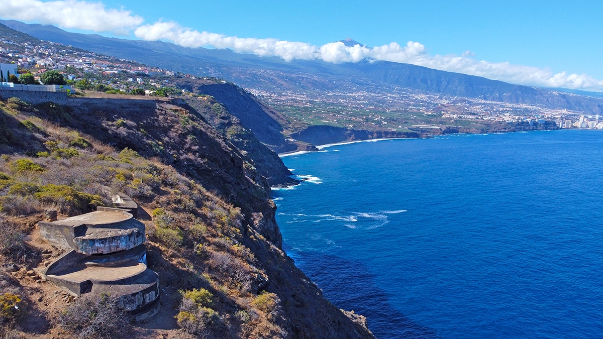
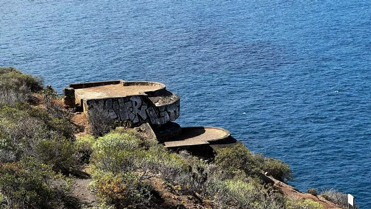
The La Quinta Bunker, also known as 11th Battery Quinta Roja, is a military construction built between 1941 and 1942 during Franco's dictatorship to defend the northern coast of Tenerife. It has two entrance passageways and two machine gun positions oriented towards the sea. It was never used for military purposes. Today it is abandoned and covered in graffiti, but its views from the cliffs at about 170 meters high over the sea make it one of the most impressive viewpoints in the Costa de Acentejo.
The access requires comfortable footwear and is not suitable for those with vertigo, as the path runs alongside the cliff. Entry is free and open. Just before reaching the bunker, the La Quinta Viewpoint offers a calmer and more accessible panoramic view of the northern coast to Puerto de la Cruz.
The historic center
The centre of Santa Úrsula preserves an architectural heritage representative of the north of TenerifeThe Parish of Santa Úrsula, Virgin and Martyr, founded in 1587 and cataloged as Cultural Heritage of Interest, presides over the historic center. Its name comes from a condition once imposed by Doña María de Gallegos when donating the land to build a church dedicated to the saint.
In the town center, there are also several chapels and manor houses from the 17th and 18th centuries. Among them are the House of the Captains — residence of Captain Diego González Martín, built in 1860 —, the former summer residence of the Marquises of Villanueva del Prado and the San Luis Hacienda, dating from the 17th century. The Canarian winepress in the La Quinta area, also preserved, is a direct vestige from when the entire municipality was a vineyard.
The Costa de Acentejo and the coves
The coast of Santa Úrsula is part of the Protected Landscape of the Costa Acentejo, a coastal strip of cliffs, ravines, and volcanic platforms that crosses several northern municipalities of the island. It is not a comfortable beach coast: it is a marine front with character, impressive views, and access ways that require effort. The Cala de Santa Ana and the Charco del Negro are the most well-known bathing spots in the municipality, small and secluded, with clean waters and a very photogenic volcanic environment. The sea state is very important before descending, especially in winter and with northerly winds.
The guachinches and the wines
Santa Úrsula is one of the northern municipalities of Tenerife with the highest concentration of guachinches. These family-run establishments pair their own harvest wine with simple Canarian dishes: wrinkled potatoes, sausages, grilled cheese, grilled meats. The atmosphere is homely, the prices very affordable, and the usual season runs from October to March. It’s best to confirm opening and hours before going, as each guachinche operates at its own pace.
The municipality is part of the Designation of Origin Tacoronte-Acentejo. Their red wines, especially those from listán negro, have a lot of character. Additionally, the recovery of vineyards in the mid-altitudes of the municipality continues to advance, with wineries combining their own production and direct sales to visitors.
How to get to Santa Úrsula
Santa Úrsula is in the north of Tenerife, about 35 kilometers from Santa Cruz de Tenerife via the TF-5 (approximately 30-35 minutes by car). From Puerto de la Cruz it is about 15 kilometers and 15-20 minutes. Access to La Quinta and the bunker is made through exit 29 of the TF-5 towards Puerto de la Cruz. TITSA buses lines 102 and 30, which connect Santa Cruz with Puerto de la Cruz, stop on the main road of the municipality. Also check the live cameras in Tenerife to help you navigate the island.
Frequently asked questions about Santa Úrsula Tenerife
What is La Giganta of Santa Úrsula?
It is a monumental four-meter-tall sculpture representing a seated female figure with a dress and hair made of living plants. It is in the La Quinta Social Garden and is the most photographed icon of Santa Úrsula. The artwork combines sculpture and landscaping in a green setting with views of the Teide.
What is the La Quinta Bunker?
It is a military battery built between 1941 and 1942 to defend the northern coast of Tenerife. It was never used for active military purposes. Today it is abandoned, but its views from the cliffs at 170 meters high over the Costa de Acentejo make it one of the most spectacular viewpoints in the north of the island. The visit is free but requires suitable footwear.
When do the guachinches of Santa Úrsula open?
The usual season is from October to March, coinciding with the new wine. Each guachinche sets its own days and hours, so it's best to confirm before going. They offer homemade Canarian food with their own harvest wine at very affordable prices.
Does Santa Úrsula have beaches?
It has no sandy beaches. Its coast is part of the Protected Landscape of the Costa Acentejo, with cliffs and volcanic platforms. The bathing areas are the Cala de Santa Ana and the Charco del Negro, two small natural coves with challenging access and clean waters. The sea conditions are crucial before going down.
What wines are produced in Santa Úrsula?
The municipality belongs to the D.O. Tacoronte-Acentejo. Their reds from listán negro have a strong character thanks to the mid-altitude volcanic soils. There are wineries with direct sales, and the guachinches in the municipality serve their own harvest wine during the opening months.
How to get to La Giganta from the highway?
Take exit 29 of the TF-5 towards Puerto de la Cruz and follow the signs to the urbanization La Quinta. The Social Garden with La Giganta has nearby parking and is a few minutes' walk from the exit.