

What to see in Artenara, Gran Canaria
The highest village in Gran Canaria, with cave houses
Artenara Gran Canaria, the highest village on the island among caves and pines
Artenara is the highest and least populated municipality of Gran Canaria. It is at 1,270 meters above sea level, in the heart of the central-western highlands of the island. Its history dates back to the indigenous Canarians, who excavated caves in volcanic rock to live over 700 years ago. Many of its inhabitants still live in caves today. Hence, Artenara it is one of the most unique municipalities of Canary Islands: without coast, without mass tourism, and with a landscape of ravines and pine forests that the writer Miguel de Unamuno described in 1910 as a «petrified storm». Additionally, it is part of the Cultural Landscape declared World Heritage by UNESCO in 2019. Check the live cameras of Gran Canaria and check the weather in real time.
The cave houses and the Ethnographic Museum
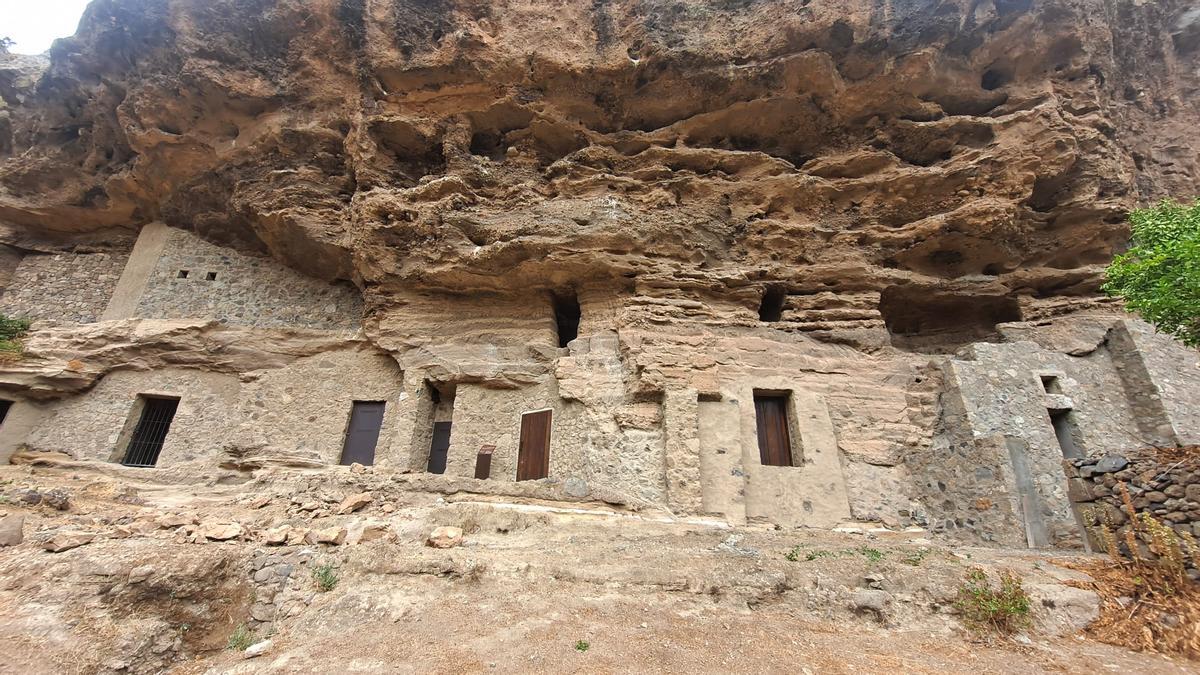
The cave houses are the most characteristic element of Artenara. The custom of living in caves excavated in the rock began with the island's aborigines and continued with the Castilian and Portuguese colonizers who arrived after the conquest in 1478. Over time, the caves have been expanded and adapted: today they contain kitchens, bedrooms, living rooms, and even terraces. Some are authentic homes with multiple interconnected rooms within the same rock.
The Ethnographic Museum Cave Houses of Artenara allows visitors to tour several caves set up as exhibits. Each one shows a different use: a main room with traditional furnishings, a winery, a crafts cave with pottery, textiles, and work tools. Additionally, the museum houses the Tourist Information Office of the municipality, open Monday to Friday from 11:30 AM to 4:30 PM. It is the ideal starting point to organize a visit to the municipality.
The Hermitage of the Virgen de la Cuevita
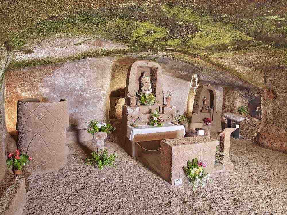
The Hermitage of the Virgen de la Cuevita is the most beloved monument of the municipality and one of the most unique in all of Gran Canaria. It is situated 400 meters from the urban center, carved into the volcanic rock on the southern slope of Montaña del Toril. Inside, the altar, pulpit, confession booth, and choir are carved directly from the stone. Everything is born from the rock. The hermitage opens every day from 9:00 AM to 7:00 PM.
The image it holds is the Virgin of the Cuevita, a wooden carving about 80 centimeters tall with the Child Jesus in her left arm and a crown of rays and stars. According to tradition, Franciscan friars brought it in the early years of the island's evangelization and placed it in a small cave in the mountain. Thus, devotion to the Virgen de la Cuevita spread throughout Gran Canaria and remains one of the most deeply rooted devotions in the interior of the island.
Risco Caído and World Heritage
The Risco Caído — formally Archaeological Complex of Risco Caído and the Sacred Mountains of Gran Canaria — was declared UNESCO World Heritage in 2019 along with the surrounding area of the Roques de Tejeda and other highland areas of the island. In the term of Artenara, the most important site of this ensemble is the Archaeological Complex of Acusa, formed by habitation and burial caves. The caves display carvings and symbolic elements of the Canarian aborigines related to fertility cults and the solar cycle.
To visit the site of Risco Caído , it is necessary to make a reservation in advance at the Interpretation Center, as access is regulated to protect the site. On the other hand, the Archaeological Complex of Acusa can be visited by car along the road that connects Artenara with the ravine. It is a route that combines archaeology and a landscape of great beauty.
The Mirador de Unamuno and the views
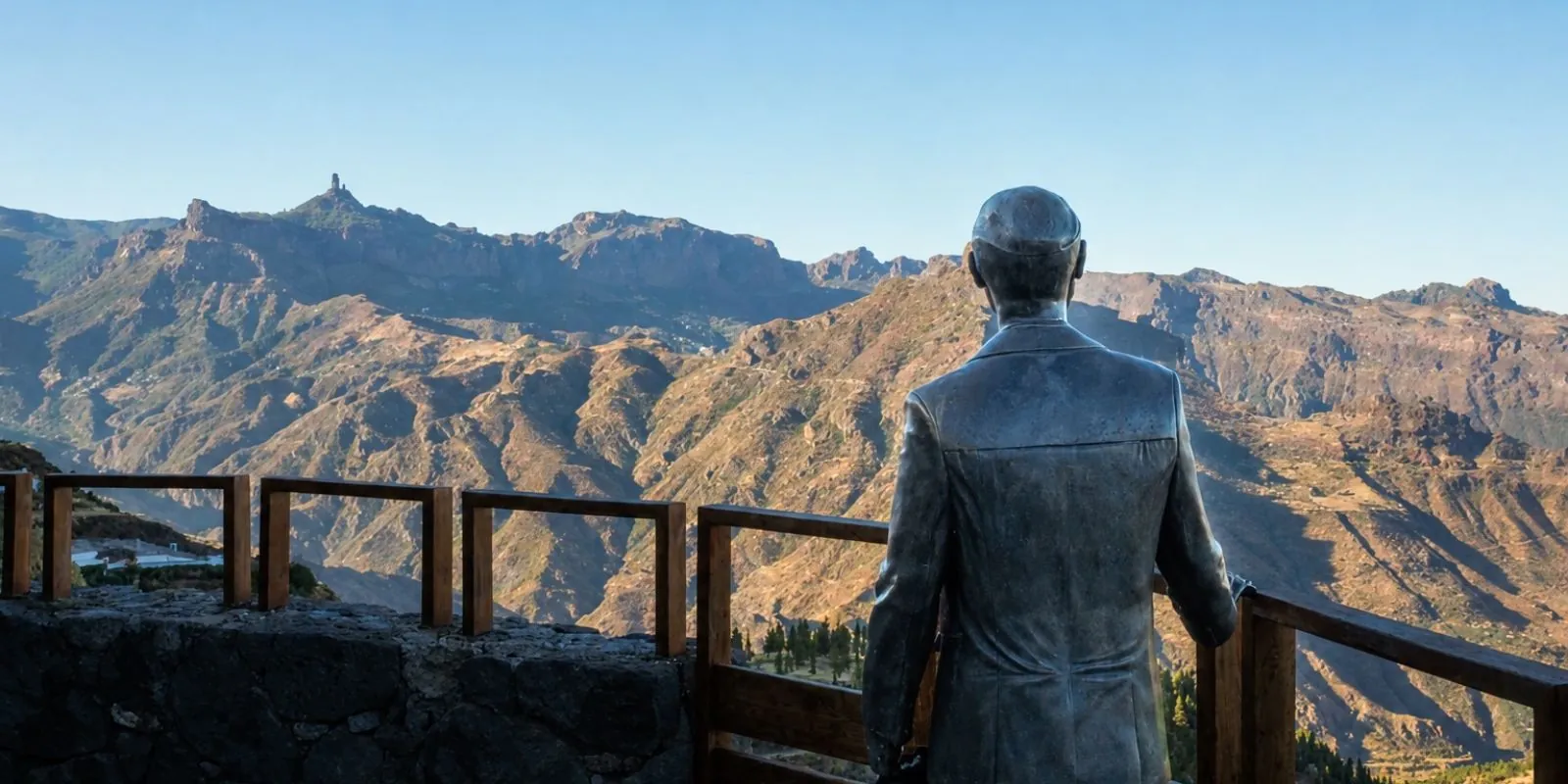
The Mirador de Unamuno is the most famous viewpoint of Artenara. It was inaugurated in 1999 to commemorate the visit of the writer and philosopher Miguel de Unamuno in 1910. From there, you can see the Roques Nublo and Bentayga, the two great sacred symbols of the aborigines of Gran Canaria, along with Caldera de Tejeda and the ravines of the island's center. A sculpture of Unamuno, created by local artist Manolo González, presides over the viewpoint.
In addition, from Artenara you get direct views of the Tamadaba Natural Park and the northwest coast on clear days. Therefore, it is one of the best points on the island to understand the geography of Gran Canaria at a glance.
Tamadaba and hiking
The Tamadaba Natural Park occupies a large part of the municipal area of Artenara. Its Canary Island pine forests, ravines, and cliff coast form one of the best-preserved natural spaces of Gran Canaria. From the town center, historic trails used by the aborigines centuries before the conquest lead out. The route to Tamadaba and the descent to the Agaete Ravine are the most valued for their landscape and moderate difficulty.
On the other hand, the Presa de Los Pérez, accessible from Artenara, has caves on its shores and views of the Tamadaba Natural Park. It is a little-known point of interest with great beauty that is worth including in a visit to the municipality.
Gastronomy in Artenara
Restaurants in Artenara serves interior Canarian cuisine: honest, made with local products, and unpretentious. The wrinkled potatoes with mojo, the rancho canario, grilled meats, and goat cheese are the typical dishes. Additionally, the municipality's pottery tradition produces ceramic pieces that can be purchased directly from the village workshops. On the other hand, the restaurant Mesón La Silla, with a terrace overlooking the ravine and views of the roques, is the most well-known and valued in the municipality for its cuisine and location.
How to get to Artenara
Artenara is in the central-west of Gran Canaria, about 50 kilometers from Las Palmas de Gran Canaria via the GC-21 road (approximately 60-70 minutes by car on mountainous roads). From Maspalomas the journey takes about 90 minutes. It is recommended to use a personal vehicle since public transport in the area is very limited. The access road is narrow and winding. From Artenara it is easy to reach the neighboring municipality of Tejeda in about 15 minutes, making it easy to combine both visits in the same day. Also check the map of the municipalities of Gran Canaria to navigate the island.
Frequently asked questions about Artenara Gran Canaria
Why are there cave houses in Artenara?
The tradition of living in caves comes from the aborigines of Gran Canaria, who excavated volcanic rock to build their homes. After the conquest in 1478, colonizers adopted the same tradition. Today, many residents of Artenara continue living in expanded and adapted caves, equipped with all modern comforts.
What is the Hermitage of the Virgen de la Cuevita?
It is a 17th-century hermitage carved into volcanic rock, 400 meters from the town of Artenara. Its altar, pulpit, confession booth, and choir are directly carved into the stone. It is open every day from 9:00 AM to 7:00 PM and is freely accessible. It is one of the most original monuments in all of Gran Canaria.
What is Risco Caído?
It is an aboriginal archaeological site declared UNESCO World Heritage in 2019 along with the Sacred Mountains of Gran Canaria. In the term of Artenara, the main complex is the Archaeological Complex of Acusa, with habitation and burial caves and carvings by the ancient Canarians. Visiting Risco Caído requires prior reservation.
What can you see from the Mirador de Unamuno?
Since the Mirador de Unamuno you can see the Roques Nublo and Bentayga, the Caldera de Tejeda and the ravines of the center of Gran Canaria. It is one of the most complete panoramas of the interior of the island. The viewpoint was inaugurated in 1999 in memory of the visit by the writer Unamuno in 1910.
Does Artenara belong to UNESCO World Heritage?
Yes. In 2019, UNESCO declared World Heritage the Paisaje Cultural del Risco Caído y las Montañas Sagradas de Gran Canaria, which includes the territory of Artenara along with the neighboring municipalities of Tejeda and Artenara. The recognition is based on the value of the aboriginal sites and the cultural landscape of the peaks.
How to get to Artenara from Las Palmas?
It is about 50 kilometers via the GC-21 road, taking 60 to 70 minutes by car through mountainous roads. It is recommended to use a personal vehicle as public transport in the area is very limited. From Artenara you can continue to Tejeda in about 15 minutes, combining both visits in a single day.