
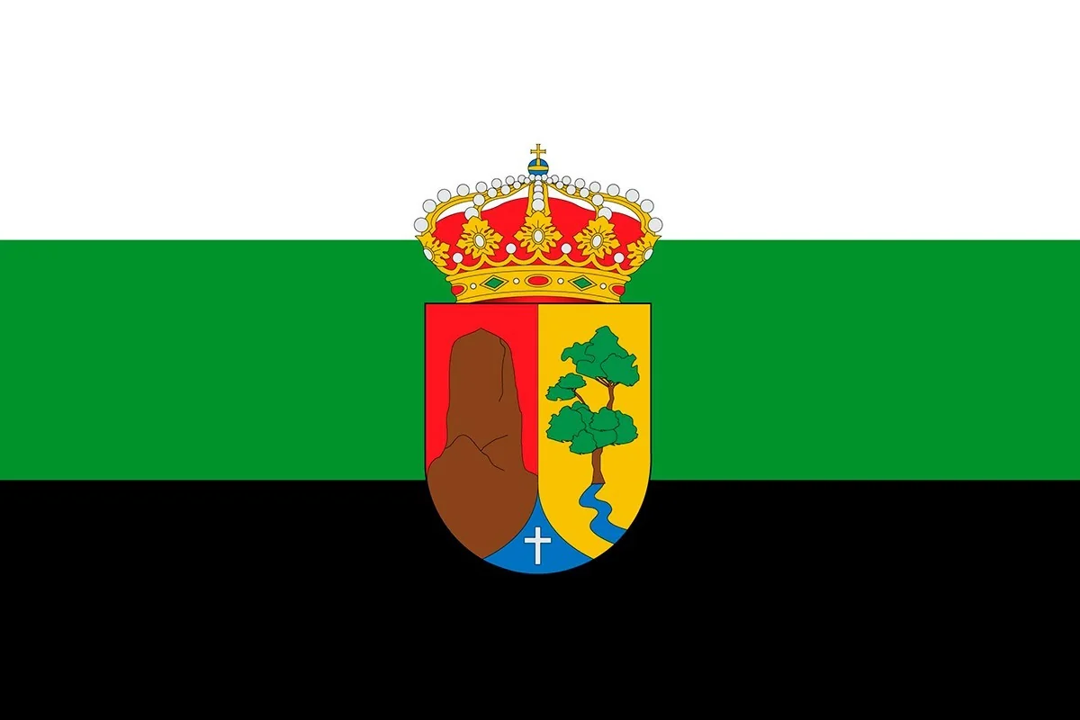
What to see in El Paso, La Palma
Caldera de Taburiente and Cumbre Vieja
El Paso La Palma, the island's green volcanic heart
El Paso is the largest municipality in La Palma and the only one with no coastline. Its territory occupies the centre of the island and climbs from 400 metres above sea level to the 2,426 metres of the Roque de los Muchachos, crossing pine forests, laurisilva, volcanic peaks and the great depression of the Taburiente Caldera. For all this, El Paso holds some of the most impressive landscapes in Canary Islands. Its territory is also where the Volcán Tajogaite was born in 2021 — the islands' most recent eruption — and it preserves one of the most singular craft traditions in the whole archipelago: the production of seda palmera. Check the Live cameras of La Palma and check the weather in real time.
The Parque Nacional de la Caldera de Taburiente
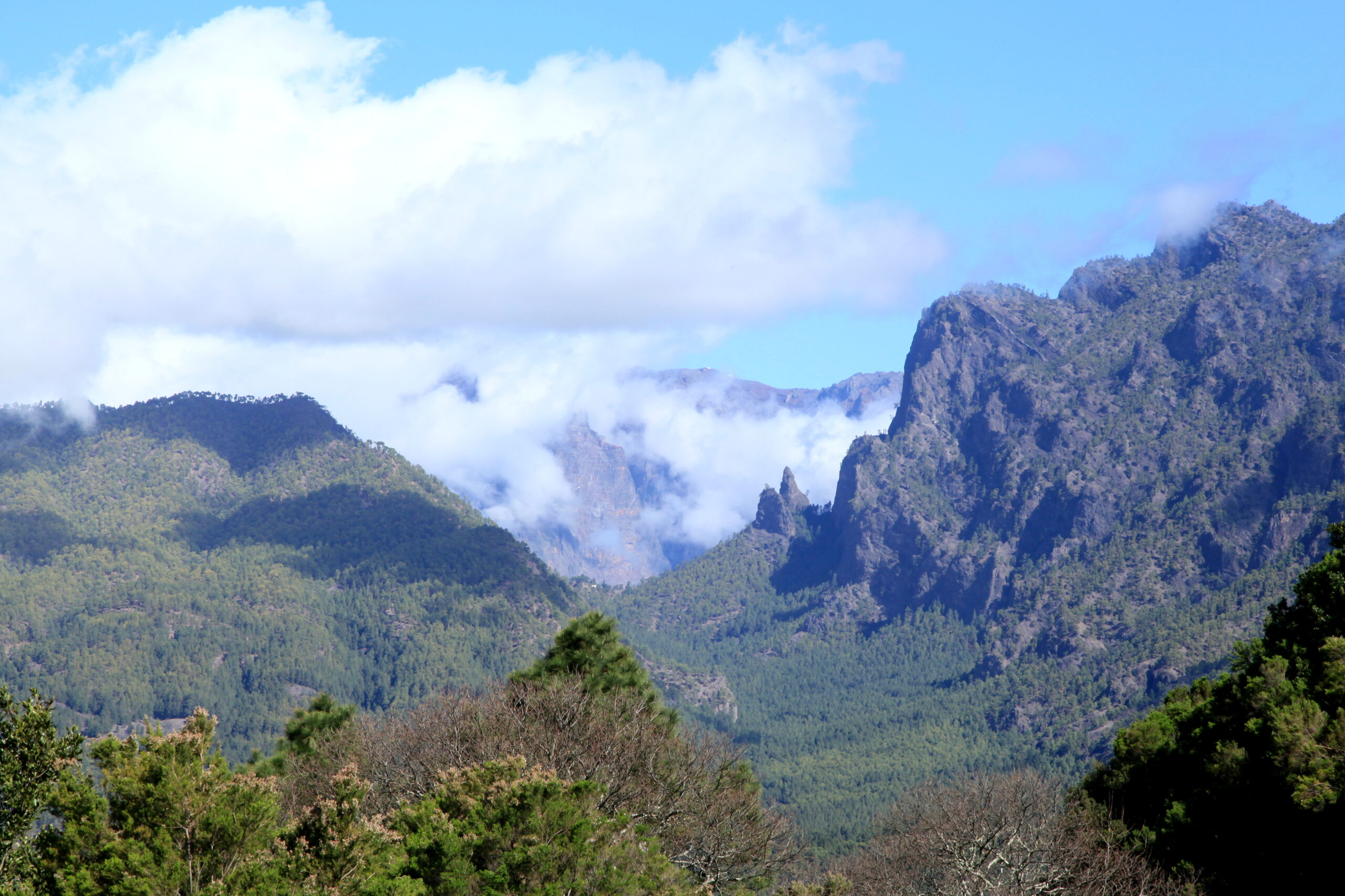
The Taburiente Caldera National Park is the most emblematic natural area in La Palma and one of the most spectacular in Spain. Its caldera, more than 8 kilometres in diameter with walls over 2,000 metres, formed from the collapse of ancient volcanic structures. Inside it, dense Canary pine forests grow, the Barranco de las Angustias runs with waterfalls and crystal-clear pools, and the Roque Idaferises, a monolith more than 70 metres tall that the Benahoaritas considered sacred.
The Mirador de La Cumbrecita is the park's most visited access point and the place offering the most complete view of the caldera. From there you can see the crater's interior, the pine forests, the Roque Idafe and, on clear days, the Roque de los Muchachos on high. The park's Visitor Center , in the same municipality, also organises guided excursions and offers information on the park's geology and flora.
The Volcán Tajogaite
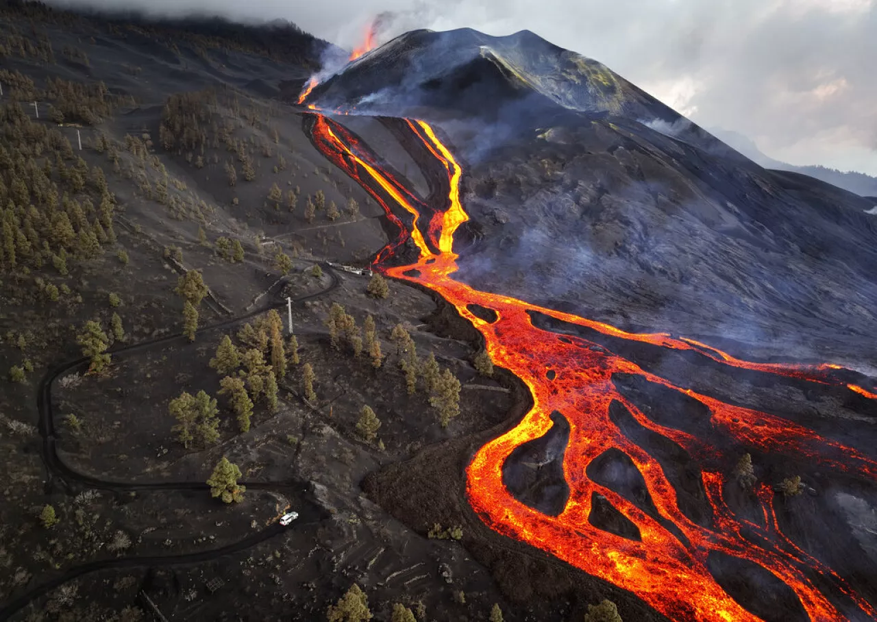
The Volcán Tajogaite erupted on 19 September 2021 and remained active for 85 days, until 13 December. It was the longest eruption in the history of La Palma and the most recent in Spanish territory. Its cone reaches 1,120 metres above sea level and has a main crater 172 metres long. The lava flow destroyed thousands of homes, crops and roads in the west of the island before reaching the sea and creating new land on the coast of Los Llanos de Aridane and Tazacorte.
Today the area around the Tajogaite is a landscape of great visual impact: still very fresh black lava fields, volcanic cones and views of the flows that came down the western slope. Because of this, the volcano has become one of the most visited destinations in La Palma. From the municipality of El Paso you can access viewpoints with direct views of the cone and the lava flows.
The Museo de la Seda
El Paso is the birthplace of seda palmera, a craft tradition more than 500 years old that made La Palma one of the leading silk producers in Spain during the 17th and 18th centuries. The Museo de la Seda Las Hilanderas lets you watch the whole process live: from raising silkworms on mulberry trees to spinning, weaving on 16th-century looms and dyeing with natural materials such as walnut shells, eucalyptus leaves and cochineal.
The museum offers guided tours and has a shop with 100% Palma silk craft products: handmade ties, scarves and bodices. It is also the only museum of its kind in Canary Islands and one of the few places in the world where you can see artisan silk production from start to finish.
The sea of clouds and the viewpoints
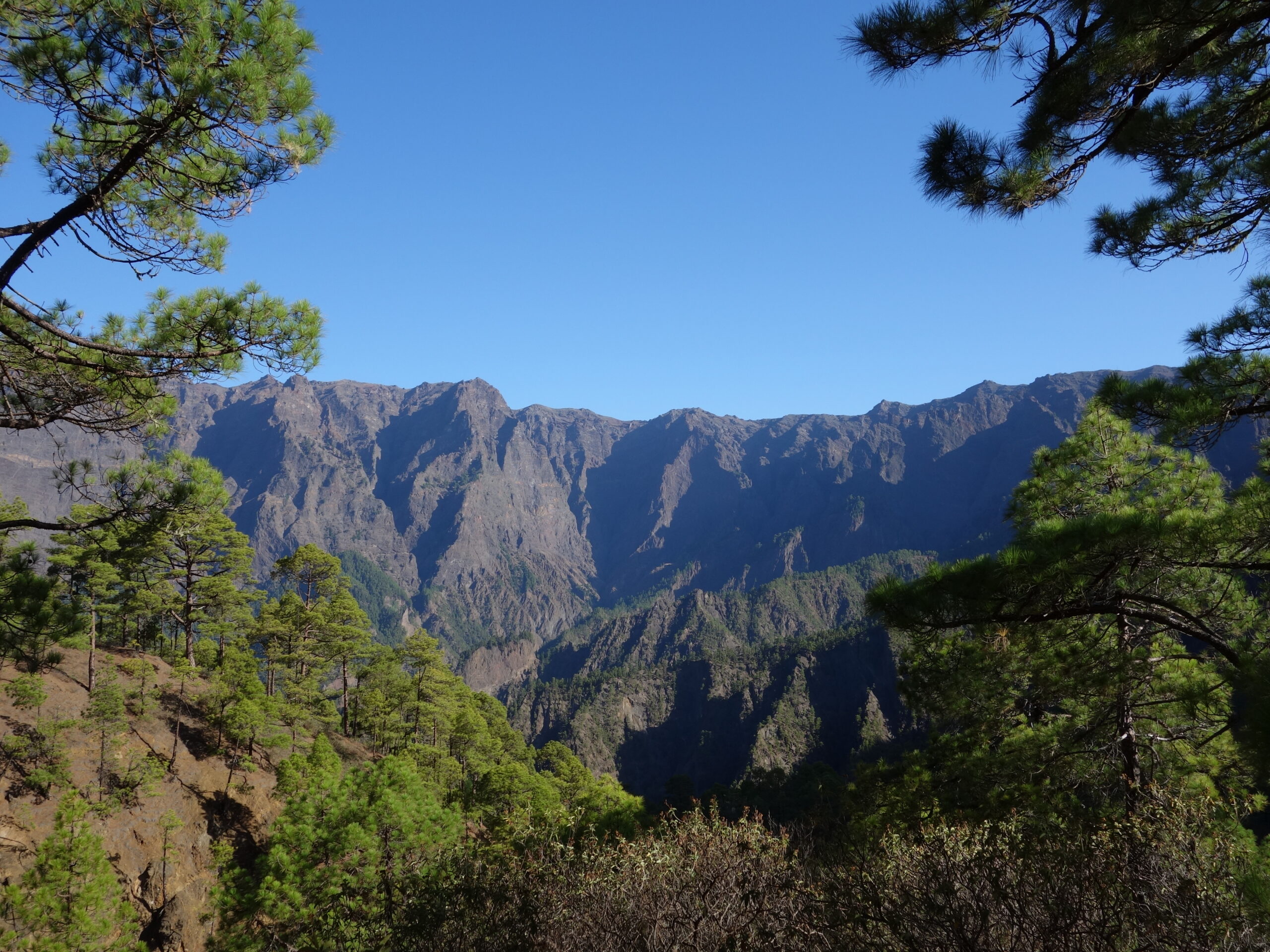
One of the most photogenic phenomena in El Paso is the sea of clouds that forms at Cumbre Nueva, the ridge that separates the east from the west of the island. When the trade winds push clouds in from the north, they build up along the ridge and cascade down the western slope, creating a unique visual spectacle. The effect is more common in summer and can be seen from several points along the road that crosses the municipality.
The Mirador del Llano del Jable, at 1,200 metres above sea level, offers spectacular views over the Valle de Aridane by day and a star-filled sky at night, since it is part of the Starlight Reserve of La Palma. Meanwhile, the Refugio de El Pilar, in the municipality's pine forest, is the starting point of the famous Route of the Volcanoes, which runs along the Cumbre Vieja ridge from north to south.
Hiking and nature
El Paso has a very complete network of trails. The Route of the Volcanoes (GR-130) is the most famous: a high-mountain route along the ridge of Cumbre Vieja among craters, lava flows and pine forests that ends in Fuencaliente. The Barranco de las Angustias, inside the Caldera de Taburiente, is another classic island route with waterfalls, pools and spectacularly coloured rock walls. Trails also set off from the municipality to the Parque Natural de Cumbre Vieja and to the Tajogaite cone itself.
Gastronomy in El Paso
The municipality's restaurants and bars serve traditional Palma cuisine: wrinkled potatoes with mojo, smoked Palma cheese, grilled meats and vegetable stews. The queso palmero, with its own designation of origin, is the municipality's best-known gastronomic product. In addition, wines from small local wineries and local artisan honey round out a locally sourced offering. The Mercado Municipal de El Paso is a good place to buy local products directly from the producers.
How to get to El Paso
El Paso is in the center of La Palma, about 17 kilometres from Santa Cruz de La Palma via the LP-3 road (approximately 25-30 minutes by car). From the La Palma Airport it's about 20 kilometres and 25 minutes. By public transport, several bus lines connect the municipality with Santa Cruz de La Palma and with the municipalities of the Valle de Aridane. A private car is recommended for visiting the Caldera de Taburiente, the Volcán Tajogaite and the peak viewpoints. Also check the Live cameras of La Palma to help you navigate the island.
Frequently asked questions about El Paso La Palma
What is the Caldera de Taburiente?
It's a National Park with a volcanic caldera more than 8 kilometres in diameter and walls up to 2,000 metres in the municipality of El Paso. Inside it, Canary pine forests grow, the Barranco de las Angustias runs with waterfalls, and the Roque Idaferises, a monolith sacred to the indigenous people. The Mirador de La Cumbrecita is the most visited access point.
What was the Volcán Tajogaite?
It was the volcanic eruption from 19 September to 13 December 2021 in the municipality of El Paso, the most recent in Spanish territory and the longest in the history of La Palma with 85 days of activity. Its cone reaches 1,120 metres and the lava flows destroyed thousands of homes before reaching the sea.
What is the Museo de la Seda in El Paso?
It is the only artisan silk museum in Canary Islands, located in the municipality of El Paso. It shows the entire silk production process of Palma silk: raising the silkworm, spinning, weaving on 16th-century looms and dyeing with natural materials. It offers guided tours and a shop of craft products.
What is the sea of clouds of Cumbre Nueva?
It is a natural phenomenon in which the trade winds push clouds in from the north up to the ridge of Cumbre Nueva, which separates the east from the west of the island. The clouds cascade down the western slope, creating a highly photographed visual spectacle. It is more common in summer and visible from several points along the road through El Paso.
What is the Ruta de los Volcanes?
It is the GR-130 trail that runs along the ridge of Cumbre Vieja from north to south, among craters, lava flows and pine forests. It sets off from the Refugio de El Pilar in the municipality of El Paso and ends in Fuencaliente. It is one of the most famous and demanding hiking routes in La Palma.
How do you get to the Mirador de La Cumbrecita?
The Mirador de La Cumbrecita is within Taburiente Caldera National Park, accessible via the LP-3 road from the municipality of El Paso. Access by private car is restricted at certain times; in high season there is a shuttle service from the designated car park. Entry to the viewpoint is free.