
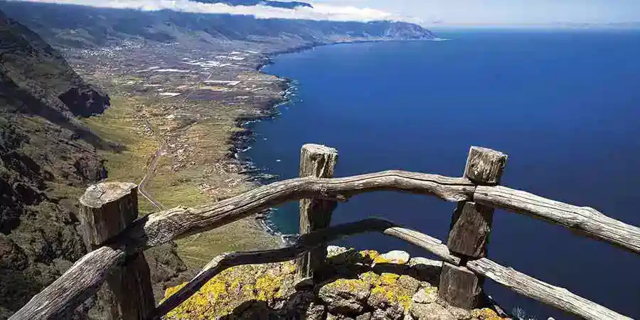
La Garita: hidden enigmas of El Hierro
They say that in El Hierro there is a «garita» without signs, without marked paths and without a clear trace on maps: a name that repeats among ravines and ancient lava flows. What is hidden behind? An ancient watchtower, a forgotten minor toponym, or simply a story that has been passed down by word of mouth?
A name without a file
If we search «La Garita» in heritage inventories, in archaeological catalogs or in the official guides of the island, it does not appear. The listings of sites in El Hierro include burial caves, petroglyphs, shell mounds, and places of aboriginal gathering, but no fortification or watchtower by that name. Neither do tourist itineraries point out a viewpoint or a tower by that name.
In other islands, there are places with that name, such as La Garita beach in Telde (Gran Canaria), and it is possible that part of the confusion comes from there.
What is a garita?
A garita is a small tower or guardhouse from which a sentinel watches over the coast or a path. They are common in coasts with military tradition, but El Hierro was never a stronghold, and its rugged terrain meant that there were few military works for centuries. The fact that a garita is not recorded is not unusual; the curious thing is that the name circulates.
Reasonable hypotheses
- A watchtower forest or coastal from the 20th century, of light construction, now disappeared.
- A livestock or fishing toponym for a cliff with good visibility, with no construction.
- A confusion with other «garitas» in the Canary Islands.
To clear doubts, it would be necessary to review the official nomenclature, historical aerial photographs, and municipal archives, and above all, ask shepherds, fishermen, and older neighbors: many place names survive in oral memory even if they do not appear on any map. If you know the place, we would love for you to tell us about it.
What El Hierro does keep
More suggestive than an anonymous tower are the well-documented secrets of the island:
- El Julán: a large aboriginal site with rock engravings, like Los Letreros, and an ancient meeting place for the bimbaches.
- The giant lizard of El Hierro: it was believed to be extinct until it was rediscovered in the cliffs of La Fuga de Gorreta, and today it can be seen in the Lagartario de Guinea.
- The Tagoro volcano: the underwater eruption of 2011 off La Restinga, one of the best-studied in the world.
- The ancient prime meridian: for centuries, many European maps measured longitude from Punta de Orchilla.
- Its skies: El Hierro is a Starlight Reserve and one of the best places in the Canary Islands to stargaze, for example from La Frontera.
An itinerary to feel the mystery
- Tomorrow: the Orchilla lighthouse and the lava fields of the western extremity.
- Noon: El Julán, with a guided visit to the archaeological area.
- Afternoon: bathing in the Charco Azul or in the natural pools of La Maceta.
- Night: starry sky from any point far from the towns.
Tips for exploring with respect
- Do not move or 'clean' archaeological remains or dry stone walls.
- Do not enter caves without a guide.
- Approach the cliffs with caution and appropriate footwear.
- If you fly a drone, check beforehand about the necessary permits.
Perhaps we will never find a tower with arrow slits. Maybe the name rests on a rock with a view of the sea, named by someone who wanted to see a watchtower there. El Hierro rewards those who ask without haste, and any new data — a coordinate, an old photo, a memory — will help to complete the island map.