
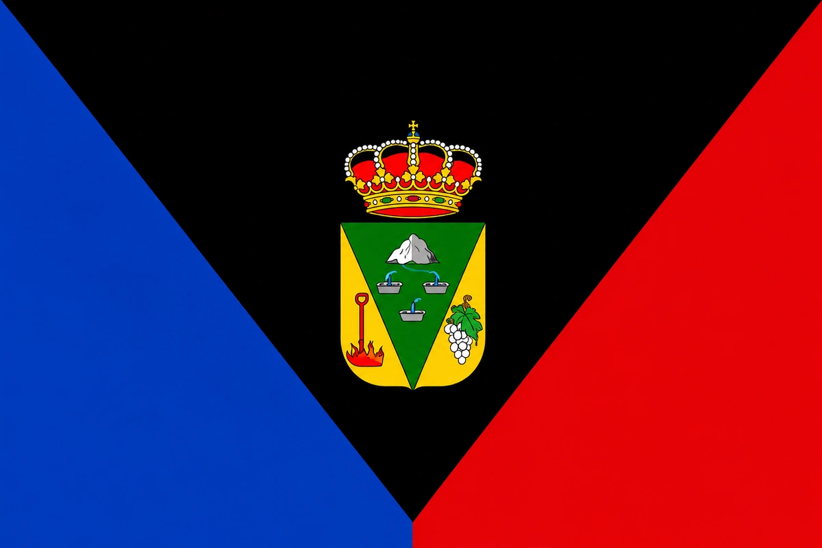
What to see in Fuencaliente, La Palma
Volcanoes, salt pans and southern wines
Fuencaliente La Palma, the volcanic south where wine is born from lava
Fuencaliente occupies the southern tip of La Palma, the island's southernmost point. Its history and landscape are shaped by volcanoes: four historic eruptions have passed through its territory — in 1646, 1677, 1712 and 1971 — and each left a layer of lava that has since become fertile soil. Because of this, Fuencaliente produces some of the best wines in Canary Islands, has the province's last working artisan salt flats, and holds a landscape of unique contrasts: volcanic black, salt white and Atlantic blue. It was also declared a Municipio Starlight in 2020 for the quality of its night sky. Check the Live cameras of La Palma and check the weather in real time.
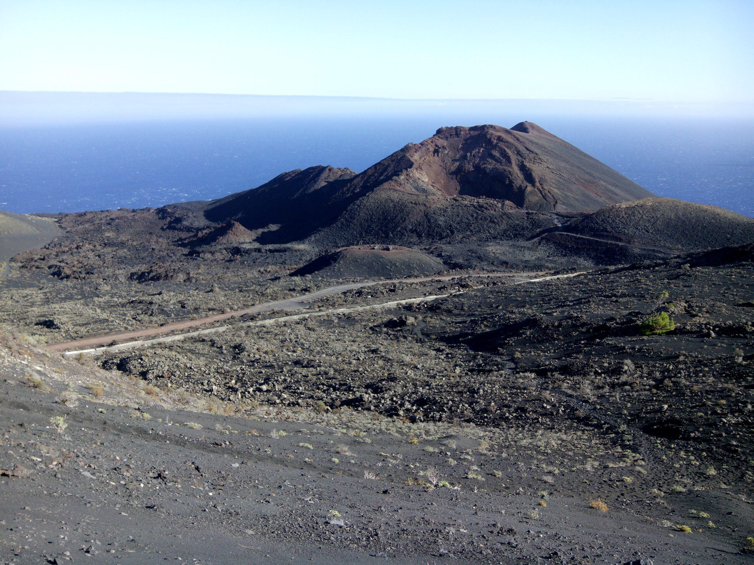
The Volcán San Antonio and the Volcán Teneguía
The Volcán San Antonio erupted in 1677 was the one that buried under lava the famous Fuente Santa, the thermal spring that gave the municipality its name. Its medicinal waters were known throughout the archipelago, and the spa that made use of them was one of the most visited in Canary Islands. The spring lay buried under metres of lava for more than three centuries, until in 2005 its thermal waters were rediscovered. The Centro de Visitantes del Volcán San Antonio lets you walk around the crater's edge and learn about the geological history of the south of the island. From there the trail also sets off towards the Volcán Teneguía.
The Volcán Teneguía was the last to erupt in La Palma, between 26 October and 18 November 1971. Its lava flow advanced towards the sea, creating new land, destroyed crops and came close to reaching the lighthouse and the salt flats. However, the lava stopped about 200 metres away. Because of this, the lava formations are still very fresh, and the landscape between the Teneguía and the coast has an almost moon-like appearance. The trail linking both volcanoes and descending to the lighthouse is one of the most spectacular routes in the south of La Palma.
The Salinas de Fuencaliente and the Lighthouse
The Salinas de Fuencaliente are the last working artisan salt flats in the province of Santa Cruz de Tenerife. Construction began in the late 1960s, and their organic sea-salt production reaches about 600 tonnes a year. They were declared a Site of Scientific Interest in 1994 for their ecological value, as the pools and their surroundings are a resting spot for migratory birds. The visual contrast between the white of the salt, the black of the volcanic rock and the blue of the ocean is one of the most photographed sights on the island. The sunset from the salt flats is also one of the most highly rated in La Palma.
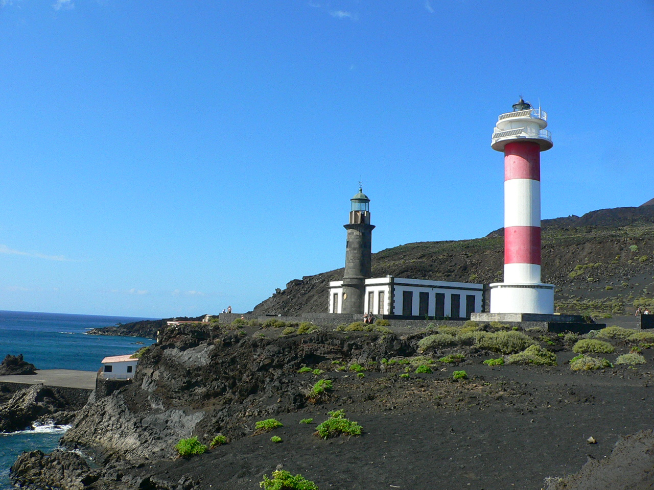
Next to the salt flats stand two lighthouses. The Faro Viejo, built in 1880 and active since 1902, was damaged in the 1939 earthquake and in the 1971 Teneguía eruption. The lava stopped just a few metres away. In 2006 it was restored and today it houses the Centro de Interpretación de la Reserva Marina de La Palma. The Faro Nuevo, 24 metres tall, was built in 1985 and is today the municipality's most recognisable symbol.
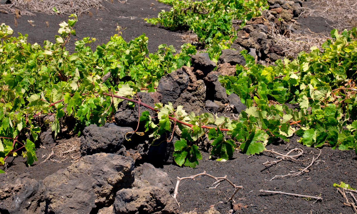
The wines of Fuencaliente
Fuencaliente is the best-known wine-producing municipality in the south of La Palma. Its vines grow directly on black volcanic lava, with barely any soil, in a landscape of great beauty and difficult cultivation. The main variety is Malvasia, which produces aromatic, fresh white wines recognised throughout Spain and with an international presence. The negramoll variety, meanwhile, produces the municipality's reds, with plenty of character and personality.
The best-known wineries are the Cooperativa Vitivinícola Fuencaliente, which brings together the area's small producers, and Llanovid. In addition, the farmers market lets you buy wine directly from local producers at weekends. For wine-tourism enthusiasts, visiting the vineyards amid black lava with the ocean in the background is an experience hard to forget.
The Playa de Echentive and the coast
The Playa de Echentive — also known as Playa del Volcán — is the municipality's most singular beach. It formed from the 1971 Teneguía lava flow and has black sand of volcanic origin. Next to it, natural pools between the lava and the sea are perfect for swimming. The atmosphere is quiet and uncrowded, with direct views of the lighthouse and the volcanoes.
Meanwhile, the Playa Zamora, a little further north, has black sand, calmer waters and slightly more infrastructure. It is the municipality's most accessible beach for families. The coast of Fuencaliente is also part of the La Palma Marine Reserve, which guarantees water quality and the richness of its seabeds.
Gastronomy in Fuencaliente
The cuisine of Fuencaliente combines produce from the volcanic countryside with fish and seafood from the south. The municipality's restaurants serve wrinkled potatoes with mojo, fresh fish, local seafood and traditional Canarian dishes. The Malvasía wine is the natural accompaniment to any meal. In addition, the municipality's typical sweets — almendrados, bizcochones and artisan pastries — are another of its attractions. The Restaurante Jardín de la Sal, right within the salt flats, offers a very special experience with direct views of the ocean and the salt flats.
How to get to Fuencaliente
Fuencaliente is at the southern tip of La Palma, about 30 kilometers from Santa Cruz de La Palma via the LP-2 road (approximately 35-40 minutes by car). From the La Palma Airport it's about 25 kilometres and 30 minutes. By public transport, the line 23 bus connects Santa Cruz de La Palma with the salt flats and the lighthouse with several daily departures, stopping at the Centro de Visitantes del Volcán San Antonio. Also check the Live cameras of La Palma to help you navigate the island.
Frequently asked questions about Fuencaliente La Palma
Why is it called Fuencaliente?
The name comes from the Fuente Santa, a medicinal thermal spring well known throughout Canary Islands. The eruption of the 1677 volcano buried the spring under metres of lava. In 2005, more than three centuries later, the thermal waters were rediscovered beneath the flow. Because of this, the municipality bears the name of that hot-water spring.
When was the last eruption in Fuencaliente?
The Volcán Teneguía erupted between 26 October and 18 November 1971. It was the last historic eruption in La Palma before the Tajogaite in 2021. The lava flow stopped about 200 metres from the lighthouse and the salt flats, also creating new territory on the coast.
What are the Salinas de Fuencaliente?
They are the last working artisan salt flats in the province of Santa Cruz de Tenerife. They produce about 600 tonnes of organic sea salt a year. They are declared a Site of Scientific Interest and are a stopping point for migratory birds. The contrast of the white salt with the black lava is one of the most photographed landscapes in La Palma.
What wines are produced in Fuencaliente?
The main variety is Malvasia, which produces aromatic, fresh white wines well recognised in Spain and internationally. The negramoll variety produces the municipality's reds. The vineyards grow directly on black volcanic lava, which gives the wines a character very much their own from the south of La Palma.
What is the Playa de Echentive like?
It is a black-sand beach formed by the lava flow of the Volcán Teneguía in 1971. Next to it there are natural pools between the lava and the sea, ideal for swimming. The atmosphere is quiet and uncrowded, with direct views of the lighthouse and the volcanoes. It is part of the La Palma Marine Reserve.
Can you visit the Volcán Teneguía?
Yes. From the Centro de Visitantes del Volcán San Antonio a trail sets off leading to the Volcán Teneguía and then descends to the lighthouse and the salt flats. The route is one of the most spectacular in the south of La Palma and lets you see up close the 1971 lava flows, still very fresh.